Approximate Location Map
Large Map »
Latitude: 51.2825 / 51°16'56"N
Longitude: 1.0818 / 1°4'54"E
OS Eastings: 615014
OS Northings: 158217
OS Grid: TR150582
Mapcode National: GBR TY2.JBP
Mapcode Global: VHLGM.P1S5
Plus Code: 9F3373JJ+XP
Entry Name: 42, St Radigund Street
Listing Date: 7 September 1973
Grade: II
Source: Historic England
Source ID: 1065779
English Heritage Legacy ID: 443279
ID on this website: 101065779
Location: Northgate, Canterbury, Kent, CT1
County: Kent
District: Canterbury
Electoral Ward/Division: Westgate
Parish: Non Civil Parish
Built-Up Area: Canterbury
Traditional County: Kent
Lieutenancy Area (Ceremonial County): Kent
Tagged with: Building
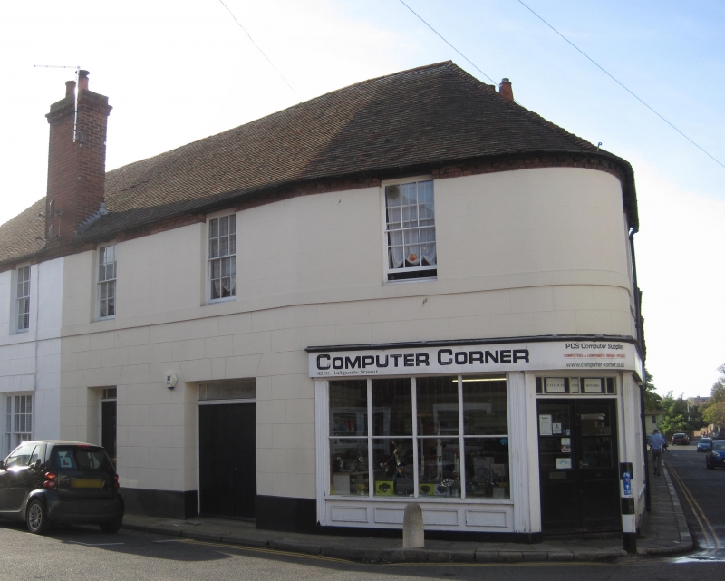
1.
944 ST RADIGUND STREET
(South Side)
No 42
TR 1558 SW 3/703
II GV
2.
Early C19. 2 storeys stuccoed. Hipped tiled roof. Rounded corner. 1 3-light
sash. Ground floor shop front with pilasters. The return to Knott's Lane
has 3 sashes,
Nos 38 to 42 (consec) form a group.
Listing NGR: TR1501258210
External links are from the relevant listing authority and, where applicable, Wikidata. Wikidata IDs may be related buildings as well as this specific building. If you want to add or update a link, you will need to do so by editing the Wikidata entry.


Other nearby listed buildings
