Approximate Location Map
Large Map »
Latitude: 52.407 / 52°24'25"N
Longitude: -1.5092 / 1°30'33"W
OS Eastings: 433486
OS Northings: 278885
OS Grid: SP334788
Mapcode National: GBR HFN.G5
Mapcode Global: VHBWY.SRJP
Plus Code: 9C4WCF4R+Q8
Entry Name: Rose and Crown Inn
Listing Date: 24 June 1974
Grade: II
Source: Historic England
Source ID: 1076613
English Heritage Legacy ID: 218498
ID on this website: 101076613
Location: Coventry, West Midlands, CV1
County: Coventry
Electoral Ward/Division: St Michael's
Parish: Non Civil Parish
Built-Up Area: Coventry
Traditional County: Warwickshire
Lieutenancy Area (Ceremonial County): West Midlands
Church of England Parish: Coventry Holy Trinity
Church of England Diocese: Coventry
Tagged with: Inn
5105
SP 3378 NW 10/288
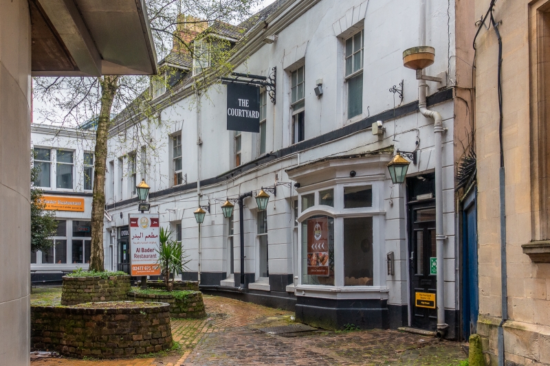
HIGH STREET (South Side)
Rose & Crown Inn
II
Circa 1800. Stucco, channelled. Welsh slated roof behind cornice and low parapet. Two storeys, sash windows.
Set back in yard, one of the few early inns surviving in central Coventry.
This entry was subject to a Minor Amendment on 20 August 2019.
External links are from the relevant listing authority and, where applicable, Wikidata. Wikidata IDs may be related buildings as well as this specific building. If you want to add or update a link, you will need to do so by editing the Wikidata entry.


Other nearby listed buildings
