Approximate Location Map
Large Map »
Latitude: 51.9046 / 51°54'16"N
Longitude: -2.9678 / 2°58'4"W
OS Eastings: 333515
OS Northings: 223339
OS Grid: SO335233
Mapcode National: GBR F7.Q4H9
Mapcode Global: VH78V.HDX8
Plus Code: 9C3VW23J+RV
Entry Name: Bridge over River Monnow Approximately 50 Metres South of Allt Yr Ynys
Listing Date: 14 March 1986
Grade: II
Source: Historic England
Source ID: 1078162
English Heritage Legacy ID: 355414
ID on this website: 101078162
Location: County of Herefordshire, HR2
County: Sir Fynwy - Monmouthshire
Civil Parish: Walterstone
Traditional County: Monmouthshire
Lieutenancy Area (Ceremonial County): Herefordshire
Church of England Parish: Walterstone
Church of England Diocese: Hereford
Tagged with: Bridge
WALTERSTONE CP
SO 32 SW
8/106
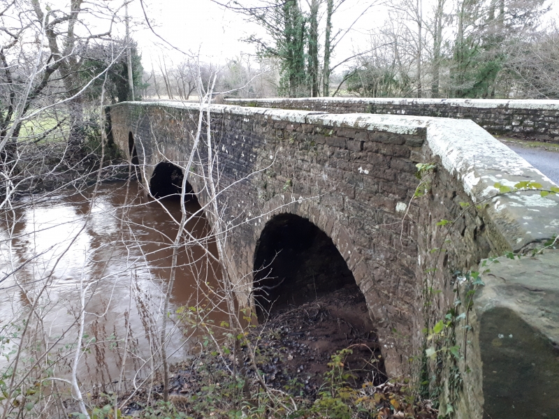
Bridge over River Monnow approximately 50 metres south of Allt Yr Ynys
II
Bridge over River Monnow. Early C19. Sandstone rubble with ashlar dressings.
Wide central span flanked by horseshoe-shaped flood arches.
This entry was subject to a Minor Amendment on 4 November 2016.
External links are from the relevant listing authority and, where applicable, Wikidata. Wikidata IDs may be related buildings as well as this specific building. If you want to add or update a link, you will need to do so by editing the Wikidata entry.


Other nearby listed buildings
