Approximate Location Map
Large Map »
Latitude: 51.4439 / 51°26'37"N
Longitude: 0.3355 / 0°20'7"E
OS Eastings: 562406
OS Northings: 174242
OS Grid: TQ624742
Mapcode National: GBR YV.R8R
Mapcode Global: VHHNW.RZR0
Plus Code: 9F32C8VP+H6
Entry Name: Garden Wall and Gate Piers to Nos 1 and 2
Listing Date: 26 July 1983
Grade: II
Source: Historic England
Source ID: 1081090
English Heritage Legacy ID: 356844
ID on this website: 101081090
Location: Northfleet, Gravesham, Kent, DA11
County: Kent
District: Gravesham
Electoral Ward/Division: Northfleet North
Parish: Non Civil Parish
Built-Up Area: Northfleet
Traditional County: Kent
Lieutenancy Area (Ceremonial County): Kent
Church of England Parish: Northfleet and Rosherville
Church of England Diocese: Rochester
Tagged with: Wall
The entry was subject to a Minor Amendment on 2 May 2017.
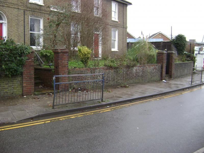
TQ 67 SW NORTHFLEET GRANBY PLACE
1/113
Garden Wall and
Gate Piers to
Nos 1 and 2
II
C19 yellow brick garden wall with capped gate piers, forming the front boundary of Nos 1 and 2 Granby Place.
Listing NGR: TQ6239174233
External links are from the relevant listing authority and, where applicable, Wikidata. Wikidata IDs may be related buildings as well as this specific building. If you want to add or update a link, you will need to do so by editing the Wikidata entry.


Other nearby listed buildings
