Approximate Location Map
Large Map »
Latitude: 51.433 / 51°25'58"N
Longitude: 0.3469 / 0°20'48"E
OS Eastings: 563236
OS Northings: 173059
OS Grid: TQ632730
Mapcode National: GBR NMQ.4HX
Mapcode Global: VHHP2.Y7SS
Plus Code: 9F32C8MW+6Q
Entry Name: Kington House
Listing Date: 4 July 1952
Grade: II
Source: Historic England
Source ID: 1081092
English Heritage Legacy ID: 356849
ID on this website: 101081092
Location: Perry Street, Gravesham, Kent, DA11
County: Kent
District: Gravesham
Electoral Ward/Division: Northfleet South
Parish: Non Civil Parish
Built-Up Area: Northfleet
Traditional County: Kent
Lieutenancy Area (Ceremonial County): Kent
Church of England Parish: Perry Street, All Saints
Church of England Diocese: Rochester
Tagged with: House
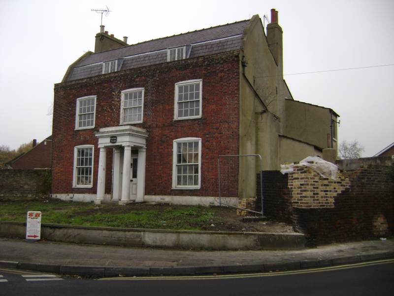
TQ 67 SW NORTHFLEET OLD PERRY STREET
1/121
4.7.52 No 38
(Kington House)
II
Early C19. Red brick with grey headers. Mansarded slate roof. Two storey and
attic. Three windows, 2 dormers. Glazing bars intact on first floor sash and attic
casement windows. Porch comprising 2 columns and 2 pilasters supporting flat roof
behind rendered parapet.
Listing NGR: TQ6323673059
External links are from the relevant listing authority and, where applicable, Wikidata. Wikidata IDs may be related buildings as well as this specific building. If you want to add or update a link, you will need to do so by editing the Wikidata entry.


Other nearby listed buildings
