Approximate Location Map
Large Map »
Latitude: 53.8375 / 53°50'14"N
Longitude: -0.4297 / 0°25'46"W
OS Eastings: 503429
OS Northings: 439058
OS Grid: TA034390
Mapcode National: GBR TSF2.R3
Mapcode Global: WHGF4.CSMZ
Plus Code: 9C5XRHPC+X4
Entry Name: 71, 73, Keldgate
Listing Date: 30 June 1987
Grade: II
Source: Historic England
Source ID: 1084038
English Heritage Legacy ID: 167211
ID on this website: 101084038
Location: Beverley, East Riding of Yorkshire, HU17
County: East Riding of Yorkshire
Civil Parish: Beverley
Built-Up Area: Beverley
Traditional County: Yorkshire
Lieutenancy Area (Ceremonial County): East Riding of Yorkshire
Church of England Parish: Beverley Minster St John and St Martin
Church of England Diocese: York
Tagged with: Building
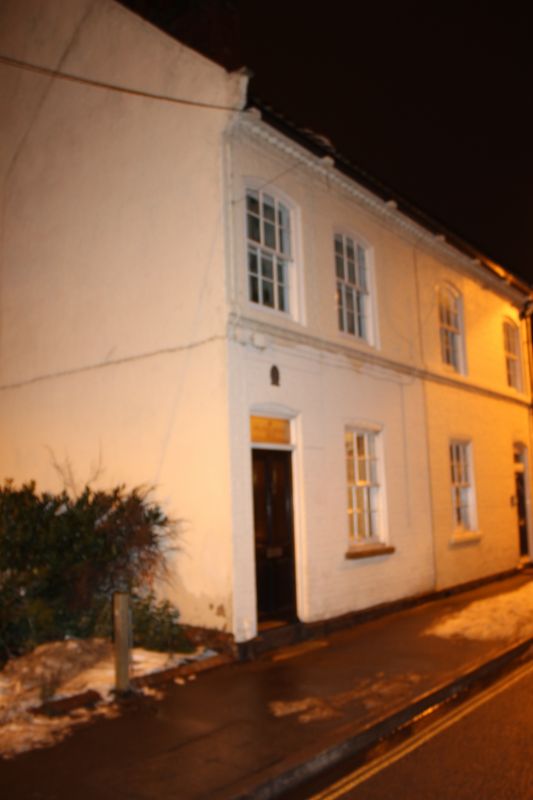
BEVERLEY KELDGATE
TA 0339 (south side)
8/111
- Nos 71 and 73
GV II
Mid Cl8. 2 storeys in painted brick with pantile roof and moulded gable ends.
Diagonal-set brick eaves cornice. 4 windows, segmental arches, hung sashes with
glazing bars. 2 windows to ground floor and 2 doors of 3 panels, plain rectan-
gular fanlights.
Listing NGR: TA0342939058
External links are from the relevant listing authority and, where applicable, Wikidata. Wikidata IDs may be related buildings as well as this specific building. If you want to add or update a link, you will need to do so by editing the Wikidata entry.


Other nearby listed buildings
