Approximate Location Map
Large Map »
Latitude: 51.3519 / 51°21'6"N
Longitude: 1.0241 / 1°1'26"E
OS Eastings: 610670
OS Northings: 165764
OS Grid: TR106657
Mapcode National: GBR TX7.1QZ
Mapcode Global: VHKJR.P8RZ
Plus Code: 9F33922F+QJ
Entry Name: Willowdene
Listing Date: 20 May 1977
Grade: II
Source: Historic England
Source ID: 1084935
English Heritage Legacy ID: 170823
ID on this website: 101084935
Location: Lower Island, Canterbury, Kent, CT5
County: Kent
District: Canterbury
Electoral Ward/Division: Gorrell
Parish: Non Civil Parish
Built-Up Area: Whitstable
Traditional County: Kent
Lieutenancy Area (Ceremonial County): Kent
Tagged with: Building
FORGE LANE
1.
5273
(South-West Side)
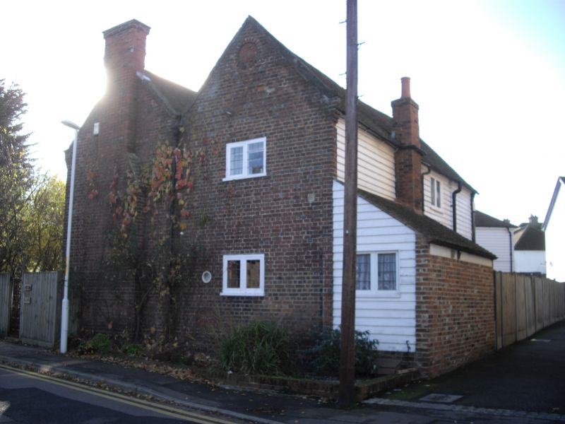
Willowdene
TR 16 NW 4/93
II
2.
2 storey red brick building of the lst half of the C18. Old clay tiled roof with
valley gutter running parallel to both roof slopes and gable ends to Forge lane.
1 cast iron original window in small square, reminder modernised and 2 bay windows
with tiled roof, all lead lights. Blind bulls-eye in 1 gable end.
Listing NGR: TR1067065764
External links are from the relevant listing authority and, where applicable, Wikidata. Wikidata IDs may be related buildings as well as this specific building. If you want to add or update a link, you will need to do so by editing the Wikidata entry.


Other nearby listed buildings
