Approximate Location Map
Large Map »
Latitude: 51.3614 / 51°21'41"N
Longitude: 1.0252 / 1°1'30"E
OS Eastings: 610702
OS Northings: 166826
OS Grid: TR107668
Mapcode National: GBR TX1.N01
Mapcode Global: VHKJR.Q1BP
Plus Code: 9F33926G+H3
Entry Name: 56, Harbour Street
Listing Date: 20 May 1977
Grade: II
Source: Historic England
Source ID: 1084939
English Heritage Legacy ID: 170831
ID on this website: 101084939
Location: Whitstable, Canterbury, Kent, CT5
County: Kent
District: Canterbury
Electoral Ward/Division: Gorrell
Parish: Non Civil Parish
Built-Up Area: Whitstable
Traditional County: Kent
Lieutenancy Area (Ceremonial County): Kent
Tagged with: Building
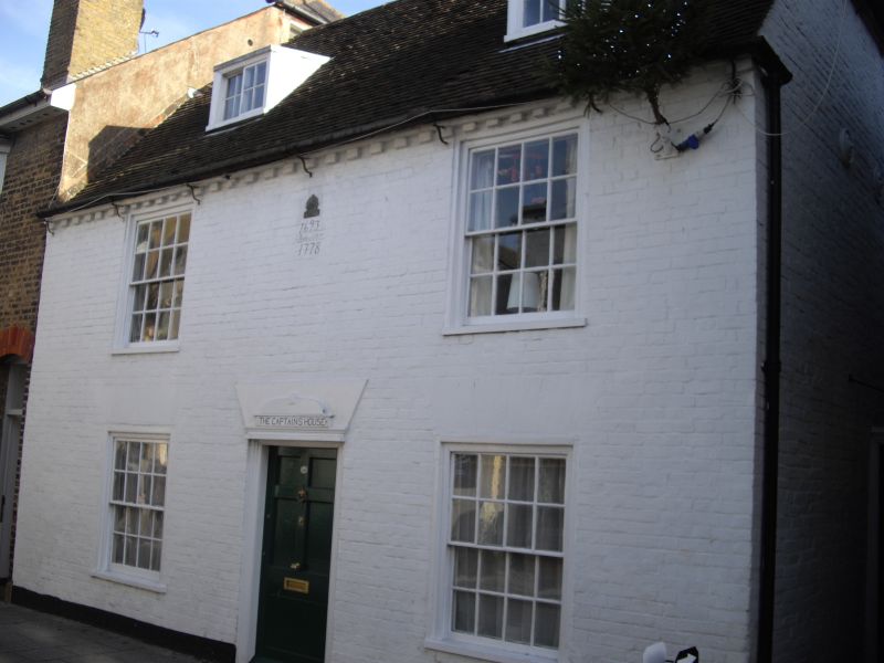
HARBOUR STREET
1.
5273
(South-East Side)
No 56
TR 1066 NE 1/107
II GV
2.
Late C18 2 storey building of red brick with attic. 2 dormers glazing bars complete.
2 box sash windows glazing bars complete. Brick dentil eaves co urse. 2 box sash
windows ground floor with glazing bars intact with flat brick arches over front
entrance door of 4 glazed panels and 1 bead flush under.
Listing NGR: TR1070266826
External links are from the relevant listing authority and, where applicable, Wikidata. Wikidata IDs may be related buildings as well as this specific building. If you want to add or update a link, you will need to do so by editing the Wikidata entry.


Other nearby listed buildings
