Approximate Location Map
Large Map »
Latitude: 51.3579 / 51°21'28"N
Longitude: 1.0203 / 1°1'12"E
OS Eastings: 610376
OS Northings: 166418
OS Grid: TR103664
Mapcode National: GBR TX1.SW8
Mapcode Global: VHKJR.M4QD
Plus Code: 9F33925C+44
Entry Name: 86, Island Wall
Listing Date: 20 May 1977
Grade: II
Source: Historic England
Source ID: 1084943
English Heritage Legacy ID: 170838
ID on this website: 101084943
Location: Lower Island, Canterbury, Kent, CT5
County: Kent
District: Canterbury
Electoral Ward/Division: Gorrell
Parish: Non Civil Parish
Built-Up Area: Whitstable
Traditional County: Kent
Lieutenancy Area (Ceremonial County): Kent
Tagged with: Building
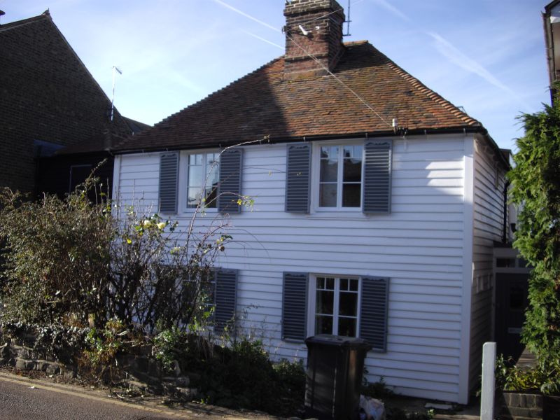
ISLAND WALL
1.
5275
(North-West Side)
No 86
TR 16 NW 4/15
II
2.
C18 building. 2 storeys, 2 windows. Fronted with minted weatherboarding. Hipped
tiled roof. Modern casements.
Listing NGR: TR1037666418
External links are from the relevant listing authority and, where applicable, Wikidata. Wikidata IDs may be related buildings as well as this specific building. If you want to add or update a link, you will need to do so by editing the Wikidata entry.


Other nearby listed buildings
