Approximate Location Map
Large Map »
Latitude: 51.3726 / 51°22'21"N
Longitude: 1.1327 / 1°7'57"E
OS Eastings: 618133
OS Northings: 168388
OS Grid: TR181683
Mapcode National: GBR TWZ.Z1X
Mapcode Global: VHLG2.LR5M
Plus Code: 9F3394FM+33
Entry Name: Grosvenor House
Listing Date: 14 May 1976
Grade: II
Source: Historic England
Source ID: 1085009
English Heritage Legacy ID: 170694
ID on this website: 101085009
Location: Herne Bay, Canterbury, Kent, CT6
County: Kent
District: Canterbury
Electoral Ward/Division: Heron
Parish: Non Civil Parish
Built-Up Area: Herne Bay
Traditional County: Kent
Lieutenancy Area (Ceremonial County): Kent
Tagged with: House
1.
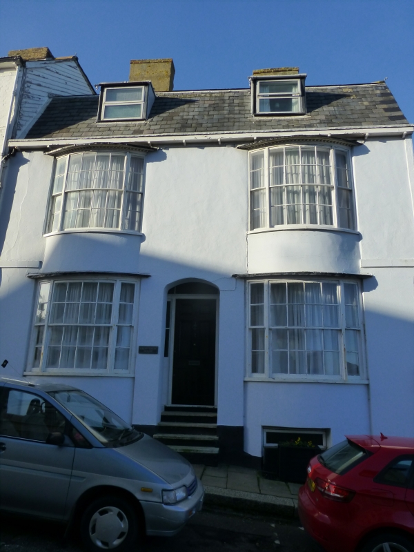
5273 EAST STREET
(West Side)
Herne Bay
--------------
No 2
(Grosvenor House)
TR 1868 SW 3/29A
II GV
2.
Early C19. 2 storeys attic and semi basement stuccoed. Mansarded slate roof with
2 dormers and bracket eaves cornice. 2 curved windows through around and 1st floor
with glazing bars intact. Recessed doorcase.
Nos 2 and 4 East Street form a group.
Listing NGR: TR1813368388
External links are from the relevant listing authority and, where applicable, Wikidata. Wikidata IDs may be related buildings as well as this specific building. If you want to add or update a link, you will need to do so by editing the Wikidata entry.


Other nearby listed buildings
