Approximate Location Map
Large Map »
Latitude: 51.2782 / 51°16'41"N
Longitude: 1.0786 / 1°4'43"E
OS Eastings: 614812
OS Northings: 157727
OS Grid: TR148577
Mapcode National: GBR TY2.X2Q
Mapcode Global: VHLGM.N43H
Plus Code: 9F3373HH+7F
Entry Name: 6, Hawks Lane
Listing Date: 3 May 1967
Grade: II
Source: Historic England
Source ID: 1085021
English Heritage Legacy ID: 170631
ID on this website: 101085021
Location: Canterbury, Kent, CT1
County: Kent
District: Canterbury
Electoral Ward/Division: Westgate
Parish: Non Civil Parish
Built-Up Area: Canterbury
Traditional County: Kent
Lieutenancy Area (Ceremonial County): Kent
Tagged with: Building
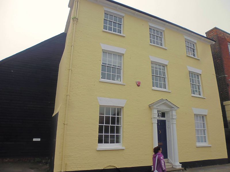
1.
944 HAWKS LANE
(South West Side)
No 6
TR 1457 NE 4/189 3.5.67.
II GV
2.
Late C18. 3 storeys and basement painted brick, Bracket cornice, 3 recessed
sashes with glazing bars intact. Doorcase has an open pediment and panelled
reveals. Tuscan columns with oak leaf capitals. Footscraper. 3 steps.
6 panelled door with fielded panels and lamp.
Nos 1, 2, extension to No 6 and Nos 6 to 15 (consec) form a group.
Listing NGR: TR1481257727
External links are from the relevant listing authority and, where applicable, Wikidata. Wikidata IDs may be related buildings as well as this specific building. If you want to add or update a link, you will need to do so by editing the Wikidata entry.


Other nearby listed buildings
