Approximate Location Map
Large Map »
Latitude: 51.2774 / 51°16'38"N
Longitude: 1.0777 / 1°4'39"E
OS Eastings: 614752
OS Northings: 157643
OS Grid: TR147576
Mapcode National: GBR TY2.WV6
Mapcode Global: VHLGM.M5M1
Plus Code: 9F3373GH+X3
Entry Name: 77, Castle Street
Listing Date: 7 September 1973
Grade: II
Source: Historic England
Source ID: 1085060
English Heritage Legacy ID: 170525
ID on this website: 101085060
Location: Canterbury, Kent, CT1
County: Kent
District: Canterbury
Electoral Ward/Division: Westgate
Parish: Non Civil Parish
Built-Up Area: Canterbury
Traditional County: Kent
Lieutenancy Area (Ceremonial County): Kent
Tagged with: Building
1.
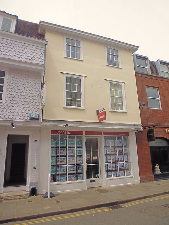
944 CASTLE STREET
(North West Side)
No 77
TR 1457 NE 4/458
II GV
2.
Outwardly early C19. 3 storeys roughcast. Parapet with wooden bracket cornice.
2 C18 sashes on 2nd floor. lst floor has 1 altered sash. Later shop front.
Graded II for group value only.
Nos 68 to 77 (consec) and Nos 80 to 82 (consec) form a group.
Listing NGR: TR1474857648
External links are from the relevant listing authority and, where applicable, Wikidata. Wikidata IDs may be related buildings as well as this specific building. If you want to add or update a link, you will need to do so by editing the Wikidata entry.


Other nearby listed buildings
