Approximate Location Map
Large Map »
Latitude: 51.2801 / 51°16'48"N
Longitude: 1.0829 / 1°4'58"E
OS Eastings: 615102
OS Northings: 157950
OS Grid: TR151579
Mapcode National: GBR TY2.QM6
Mapcode Global: VHLGM.Q3C1
Plus Code: 9F3373JM+25
Entry Name: Chapter House to Christchurch Cathedral
Listing Date: 7 September 1973
Grade: I
Source: Historic England
Source ID: 1085063
English Heritage Legacy ID: 170530
ID on this website: 101085063
Location: Christ Church Cathedral, Canterbury, Kent, CT1
County: Kent
District: Canterbury
Electoral Ward/Division: Westgate
Parish: Non Civil Parish
Built-Up Area: Canterbury
Traditional County: Kent
Lieutenancy Area (Ceremonial County): Kent
Tagged with: Architectural structure Chapter house
1.
944 THE CATHEDRAL PRECINCTS
Chapter House to
Christchurch Cathedral
TR 1557 NW 5/1B
I
2.
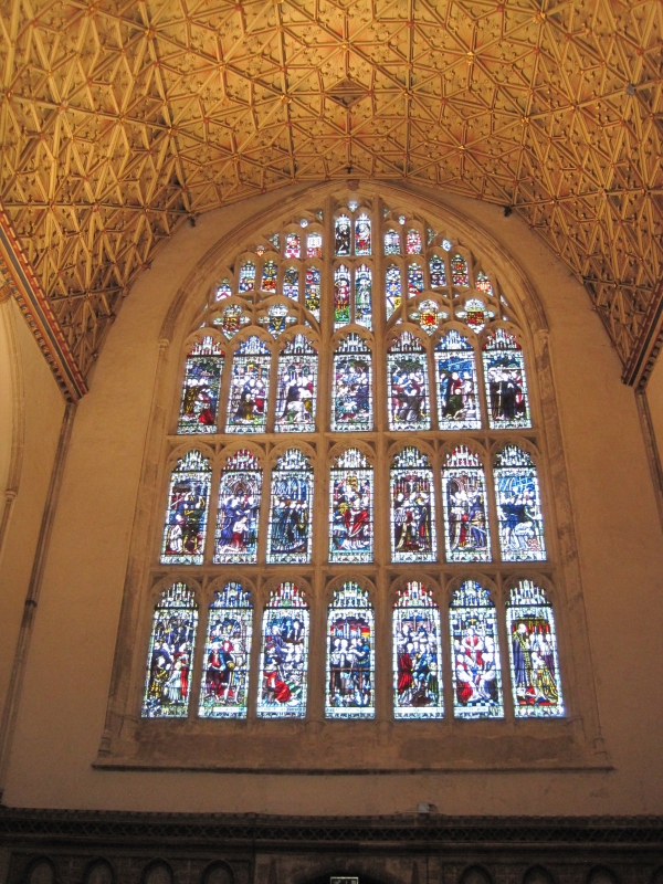
Formerly the Chapter House to the monastery of Christ Church. The present
building dates from 1304 and has a simple arcade of pointed trefoil arches.
Fine wooden waggon vault roof of 1397.
Listing NGR: TR1510557948
External links are from the relevant listing authority and, where applicable, Wikidata. Wikidata IDs may be related buildings as well as this specific building. If you want to add or update a link, you will need to do so by editing the Wikidata entry.


Other nearby listed buildings
