Approximate Location Map
Large Map »
Latitude: 51.2819 / 51°16'54"N
Longitude: 1.0839 / 1°5'1"E
OS Eastings: 615160
OS Northings: 158162
OS Grid: TR151581
Mapcode National: GBR TY2.JV7
Mapcode Global: VHLGM.Q1VL
Plus Code: 9F3373JM+QH
Entry Name: 85 and 86, Broad Street
Listing Date: 7 September 1973
Grade: II
Source: Historic England
Source ID: 1085107
English Heritage Legacy ID: 170438
ID on this website: 101085107
Location: Northgate, Canterbury, Kent, CT1
County: Kent
District: Canterbury
Electoral Ward/Division: Westgate
Parish: Non Civil Parish
Built-Up Area: Canterbury
Traditional County: Kent
Lieutenancy Area (Ceremonial County): Kent
Tagged with: Building
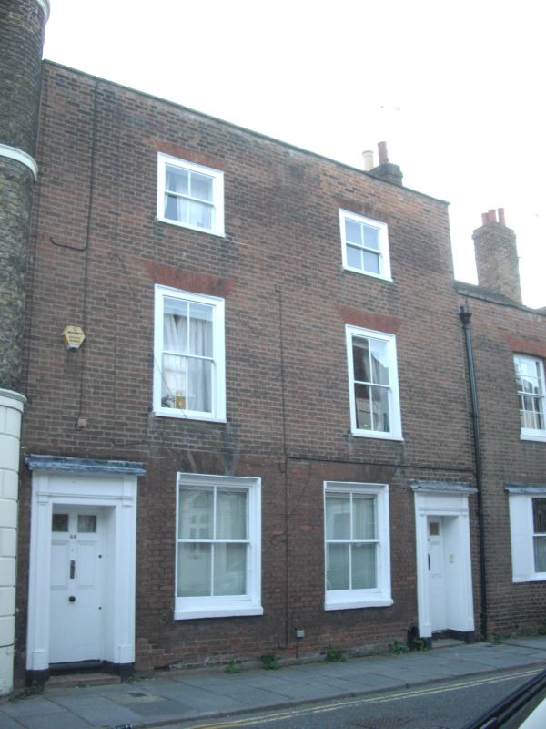
1.
944 BROAD STREET
(South West Side)
Nos 85 and 86
TR 1558 SW 3/295
II GV'
2.
Late C18 or early C19 pair. 3 storeys red brick. Stone coping. 2 sashes
with verticals only in moulded wooden architraves. Doorcases have cornices
with modillions and pilasters. 6 panelled doors with 2 panels cut out to
form the fanlight.
Nos 80 to 89 (consec) form a group.
Listing NGR: TR1514958170
External links are from the relevant listing authority and, where applicable, Wikidata. Wikidata IDs may be related buildings as well as this specific building. If you want to add or update a link, you will need to do so by editing the Wikidata entry.


Other nearby listed buildings
