Approximate Location Map
Large Map »
Latitude: 51.2779 / 51°16'40"N
Longitude: 1.0781 / 1°4'41"E
OS Eastings: 614779
OS Northings: 157698
OS Grid: TR147576
Mapcode National: GBR TY2.WYX
Mapcode Global: VHLGM.M4VP
Plus Code: 9F3373HH+57
Entry Name: 9, Beer Cart Lane
Listing Date: 7 September 1973
Grade: II
Source: Historic England
Source ID: 1085166
English Heritage Legacy ID: 170371
ID on this website: 101085166
Location: Canterbury, Kent, CT1
County: Kent
District: Canterbury
Electoral Ward/Division: Westgate
Parish: Non Civil Parish
Built-Up Area: Canterbury
Traditional County: Kent
Lieutenancy Area (Ceremonial County): Kent
Tagged with: Building
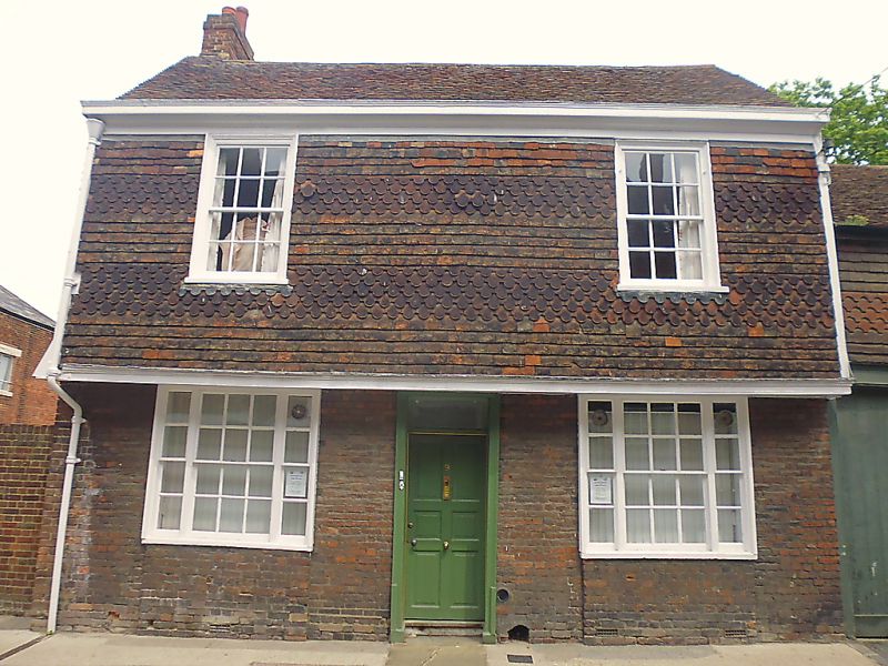
1.
944 BEER CART LANE
(North East Side)
No 9
TR1457 NE 4/351
II GV
2. "
A timber-framed building refronted in the Cl8. 2 storeys, ground floor brick.
First floor hung with fishscale tiles. Old tiled roof. 2 C19 sashes. Triple
sashes on ground floor. Plain doorcase with 6 fielded panelled door. Side
elevation is tile-hung. Coachhouse extension with a hipped dormer and a trap
door.
Nos 6 to 9 (consec) form a group.
Listing NGR: TR1478657702
External links are from the relevant listing authority and, where applicable, Wikidata. Wikidata IDs may be related buildings as well as this specific building. If you want to add or update a link, you will need to do so by editing the Wikidata entry.


Other nearby listed buildings
