Approximate Location Map
Large Map »
Latitude: 54.2121 / 54°12'43"N
Longitude: -3.0806 / 3°4'50"W
OS Eastings: 329626
OS Northings: 480131
OS Grid: SD296801
Mapcode National: GBR 6MXQ.VV
Mapcode Global: WH725.ND89
Plus Code: 9C6R6W69+RQ
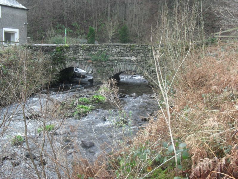
Entry Name: Bridge to North of Newland Bottom Mill
Listing Date: 5 March 1990
Grade: II
Source: Historic England
Source ID: 1086832
English Heritage Legacy ID: 75860
ID on this website: 101086832
Location: Newland Bottom, Westmorland and Furness, Cumbria, LA12
County: Cumbria
District: South Lakeland
Civil Parish: Egton with Newland
Traditional County: Lancashire
Lieutenancy Area (Ceremonial County): Cumbria
Church of England Parish: Egton cum Newland St Mary the Virgin
Church of England Diocese: Carlisle
Tagged with: Bridge
SD 28 SE EGTON WITH NEWLAND
13/87 Bridge to north of Newland
Bottom Mill (q.v.)
II
Bridge C19. Slate rubble. Segmental arch and straight parapets.
Listing NGR: SD2962680131
External links are from the relevant listing authority and, where applicable, Wikidata. Wikidata IDs may be related buildings as well as this specific building. If you want to add or update a link, you will need to do so by editing the Wikidata entry.


Other nearby listed buildings
