Approximate Location Map
Large Map »
Latitude: 51.386 / 51°23'9"N
Longitude: 1.3831 / 1°22'59"E
OS Eastings: 635490
OS Northings: 170648
OS Grid: TR354706
Mapcode National: GBR WZZ.2HM
Mapcode Global: VHLG6.XFKC
Plus Code: 9F3399PM+97
Entry Name: Gordon House
Listing Date: 20 July 1972
Grade: II
Source: Historic England
Source ID: 1088954
English Heritage Legacy ID: 356522
ID on this website: 101088954
Location: Margate, Thanet, Kent, CT9
County: Kent
District: Thanet
Electoral Ward/Division: Margate Central
Parish: Non Civil Parish
Built-Up Area: Margate
Traditional County: Kent
Lieutenancy Area (Ceremonial County): Kent
Tagged with: House
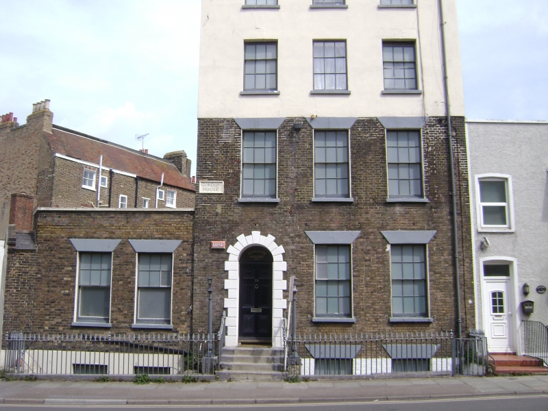
CHURCHFIELD PLACE
1.
1380
No 10
(Gordon House)
TR 3570 NW 1/55 20.7.72.
II
2.
Early C19. 4 storeys and basement with area. Stock brick. 2 top floors
cement rendered. 3 sashes with most glazing bars intact. Stone heads and
cills. Round-headed rusticated doorcase with semi-circular fanlight and
6 panel moulded door. Cast iron spear railings to area.
Listing NGR: TR3549070648
External links are from the relevant listing authority and, where applicable, Wikidata. Wikidata IDs may be related buildings as well as this specific building. If you want to add or update a link, you will need to do so by editing the Wikidata entry.


Other nearby listed buildings
