Approximate Location Map
Large Map »
Latitude: 51.3896 / 51°23'22"N
Longitude: 1.3816 / 1°22'53"E
OS Eastings: 635365
OS Northings: 171042
OS Grid: TR353710
Mapcode National: GBR WZS.VGG
Mapcode Global: VHLG6.WBRL
Plus Code: 9F3399QJ+RJ
Entry Name: Wellington Hotel
Listing Date: 22 February 1973
Grade: II
Source: Historic England
Source ID: 1088956
English Heritage Legacy ID: 356526
ID on this website: 101088956
Location: Margate, Thanet, Kent, CT9
County: Kent
District: Thanet
Electoral Ward/Division: Margate Central
Parish: Non Civil Parish
Built-Up Area: Margate
Traditional County: Kent
Lieutenancy Area (Ceremonial County): Kent
Tagged with: Hotel
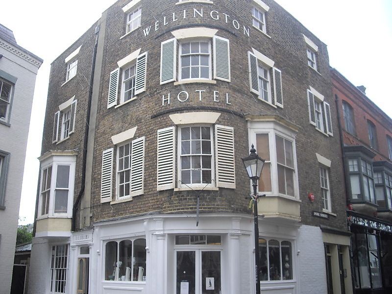
DUKE STREET
1.
1380
(South Side)
Wellington Hotel
TR 3571 SW 2/146
II
2.
A corner building. Early C19. 4 storeys stock brick. Stone coping. 5 sashes
in all with some wooden shutters and 2 1st floor 3-light canted bays. Early
C19 pub front with pilasters.
Listing NGR: TR3536571042
External links are from the relevant listing authority and, where applicable, Wikidata. Wikidata IDs may be related buildings as well as this specific building. If you want to add or update a link, you will need to do so by editing the Wikidata entry.


Other nearby listed buildings
