Approximate Location Map
Large Map »
Latitude: 51.3898 / 51°23'23"N
Longitude: 1.3814 / 1°22'53"E
OS Eastings: 635353
OS Northings: 171065
OS Grid: TR353710
Mapcode National: GBR WZS.VF2
Mapcode Global: VHLG6.WBPF
Plus Code: 9F3399QJ+WH
Entry Name: 10, Duke Street
Listing Date: 22 February 1973
Grade: II
Source: Historic England
Source ID: 1088958
English Heritage Legacy ID: 356530
ID on this website: 101088958
Location: Margate, Thanet, Kent, CT9
County: Kent
District: Thanet
Electoral Ward/Division: Margate Central
Parish: Non Civil Parish
Built-Up Area: Margate
Traditional County: Kent
Lieutenancy Area (Ceremonial County): Kent
Tagged with: Building
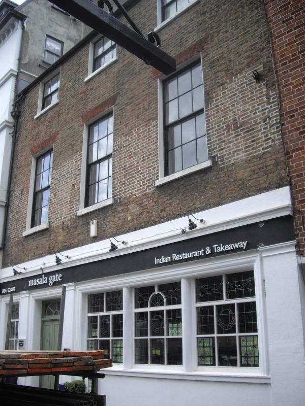
DUKE STREET
1,
1380
(North Side)
No 10
TR 3571 SW 2/149
II GV
2.
Now part of Ruby Lounge Public House.
Early C19. 3 storeys stock brick. 3 sashes with glazing bars intact and stone
cills. C19 bar front.
Nos 2 to 10 (even) form a group
Listing NGR: TR3535371065
External links are from the relevant listing authority and, where applicable, Wikidata. Wikidata IDs may be related buildings as well as this specific building. If you want to add or update a link, you will need to do so by editing the Wikidata entry.


Other nearby listed buildings
