Approximate Location Map
Large Map »
Latitude: 51.3909 / 51°23'27"N
Longitude: 1.3825 / 1°22'56"E
OS Eastings: 635418
OS Northings: 171190
OS Grid: TR354711
Mapcode National: GBR WZS.NBR
Mapcode Global: VHLG6.X96L
Plus Code: 9F3399RJ+9X
Entry Name: 32, Fort Hill
Listing Date: 22 February 1973
Grade: II
Source: Historic England
Source ID: 1088961
English Heritage Legacy ID: 356536
ID on this website: 101088961
Location: Margate, Thanet, Kent, CT9
County: Kent
District: Thanet
Electoral Ward/Division: Margate Central
Parish: Non Civil Parish
Built-Up Area: Margate
Traditional County: Kent
Lieutenancy Area (Ceremonial County): Kent
Tagged with: Building
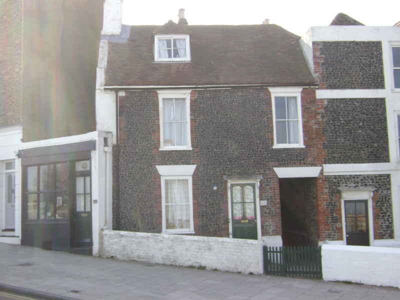
FORT HILL
1.
1380
No 32
TR 3571 SW 2/158
II GV
2.
C18. 2 storeys flint faced. Tiled roof with 1 hipped dormer. 2 sashes with
diamond panes. Right side doorcase with semi-hood and wooden brackets. Right
side entry.
No 32 forms a group with No 30
Listing NGR: TR3541871190
External links are from the relevant listing authority and, where applicable, Wikidata. Wikidata IDs may be related buildings as well as this specific building. If you want to add or update a link, you will need to do so by editing the Wikidata entry.


Other nearby listed buildings
