Approximate Location Map
Large Map »
Latitude: 51.3855 / 51°23'7"N
Longitude: 1.3811 / 1°22'52"E
OS Eastings: 635354
OS Northings: 170586
OS Grid: TR353705
Mapcode National: GBR WZZ.20F
Mapcode Global: VHLG6.WFJR
Plus Code: 9F3399PJ+5F
Entry Name: 64, Grosvenor Place
Listing Date: 22 February 1973
Grade: II
Source: Historic England
Source ID: 1088963
English Heritage Legacy ID: 356543
ID on this website: 101088963
Location: Margate, Thanet, Kent, CT9
County: Kent
District: Thanet
Electoral Ward/Division: Margate Central
Parish: Non Civil Parish
Built-Up Area: Margate
Traditional County: Kent
Lieutenancy Area (Ceremonial County): Kent
Tagged with: Building
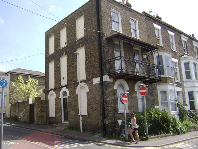
GROSVENOR PLACE
1.
1380
(East Side)
No 64
TR 3570 NW 1/166
ll GV
2.
Early C19. 3 storeys and basement stock brick, Stone coping. 2 sashes on
the front elevation with glazing bars intact. Area railings. The doorcase, which
is on the side elevation is round-headed and has a semi-circular fanlight. 2
steps. 3 blanks.
Nos 48 to 64 (even) form a group
Listing NGR: TR3535470586
External links are from the relevant listing authority and, where applicable, Wikidata. Wikidata IDs may be related buildings as well as this specific building. If you want to add or update a link, you will need to do so by editing the Wikidata entry.


Other nearby listed buildings
