Approximate Location Map
Large Map »
Latitude: 51.3864 / 51°23'11"N
Longitude: 1.3842 / 1°23'3"E
OS Eastings: 635561
OS Northings: 170699
OS Grid: TR355706
Mapcode National: GBR WZZ.2R4
Mapcode Global: VHLG6.YF30
Plus Code: 9F3399PM+HM
Entry Name: 24, Hawley Square
Listing Date: 22 February 1973
Grade: II
Source: Historic England
Source ID: 1088973
English Heritage Legacy ID: 356561
ID on this website: 101088973
Location: Margate, Thanet, Kent, CT9
County: Kent
District: Thanet
Electoral Ward/Division: Margate Central
Parish: Non Civil Parish
Built-Up Area: Margate
Traditional County: Kent
Lieutenancy Area (Ceremonial County): Kent
Tagged with: Building
HAWLEY SQUARE
1.
1380
(East Side)
No 24
TR 3570 NE 6/42
II GV
2.
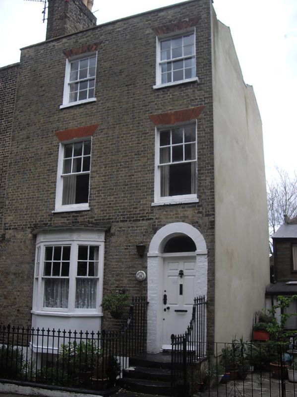
Early C19. 3 storeys and basement brown brick. Stone parapet. 2 sashes with
most glazing bars intact. Left side 3 light canted bay and right side round-
headed doorcase with 6 panelled door. Spear railings.
Nos 19 to 24 (consec) and Nos 26 and 27 form a group
Listing NGR: TR3556170699
External links are from the relevant listing authority and, where applicable, Wikidata. Wikidata IDs may be related buildings as well as this specific building. If you want to add or update a link, you will need to do so by editing the Wikidata entry.


Other nearby listed buildings
