Approximate Location Map
Large Map »
Latitude: 51.3877 / 51°23'15"N
Longitude: 1.3799 / 1°22'47"E
OS Eastings: 635254
OS Northings: 170825
OS Grid: TR352708
Mapcode National: GBR WZS.TZM
Mapcode Global: VHLG6.VDV1
Plus Code: 9F3399QH+3W
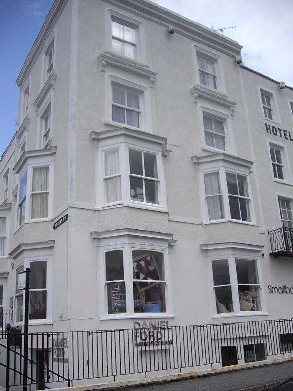
Entry Name: 13, Albert Terrace
Listing Date: 22 February 1973
Grade: II
Source: Historic England
Source ID: 1088979
English Heritage Legacy ID: 356479
ID on this website: 101088979
Location: Margate, Thanet, Kent, CT9
County: Kent
District: Thanet
Electoral Ward/Division: Margate Central
Parish: Non Civil Parish
Built-Up Area: Margate
Traditional County: Kent
Lieutenancy Area (Ceremonial County): Kent
Tagged with: Building
ALBERT TERRACE
1.
1380
No 13
TR 3570 NW 1/101
II GV
2.
A mid C19 corner building. 4 storeys and basement stock brick. 2 sashes on
each elevation with Italianate architraves. Some 3-light canted bays. Left
side round-headed doorcase. Area Railings.
Nos 3 to 19A (consec) form a group
Also Nos 13 to 19A (consec) form a group with Nos 20, 20A and 21 Marine Gardens
Listing NGR: TR3525470825
External links are from the relevant listing authority and, where applicable, Wikidata. Wikidata IDs may be related buildings as well as this specific building. If you want to add or update a link, you will need to do so by editing the Wikidata entry.


Other nearby listed buildings
