Approximate Location Map
Large Map »
Latitude: 51.3876 / 51°23'15"N
Longitude: 1.38 / 1°22'47"E
OS Eastings: 635263
OS Northings: 170812
OS Grid: TR352708
Mapcode National: GBR WZS.V0Z
Mapcode Global: VHLG6.VDX4
Plus Code: 9F3399QH+2X
Entry Name: 16, Albert Terrace
Listing Date: 22 February 1973
Grade: II
Source: Historic England
Source ID: 1088980
English Heritage Legacy ID: 356481
ID on this website: 101088980
Location: Margate, Thanet, Kent, CT9
County: Kent
District: Thanet
Electoral Ward/Division: Margate Central
Parish: Non Civil Parish
Built-Up Area: Margate
Traditional County: Kent
Lieutenancy Area (Ceremonial County): Kent
Tagged with: Building
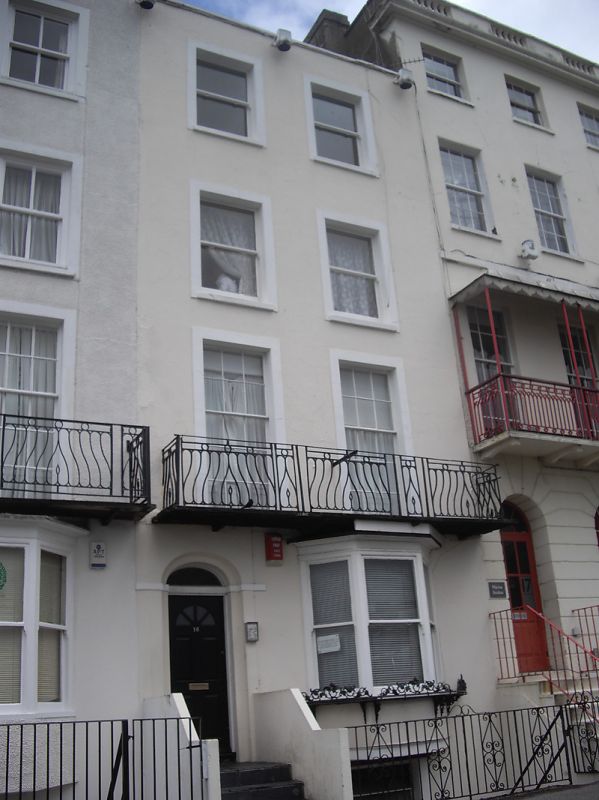
ALBERT TERRACE
1.
1380 No 16
TR 3570 NW 1/29
II GV
2.
Circa 1840. 4 storeys stuccoed. Stone coping. 2 sashes with most glazing
bars missing. The 1st floor has a cast iron trellis-Work balcony. Left side
round-headed doorcase with 6 panelled door and 3 light canted bay.
Nos 3 to 19A (consec) form a group
Also Nos 13 to 19A (consec) form a group with Nos 20, 20A and 21 Marine Gardens
Listing NGR: TR3526370812
External links are from the relevant listing authority and, where applicable, Wikidata. Wikidata IDs may be related buildings as well as this specific building. If you want to add or update a link, you will need to do so by editing the Wikidata entry.


Other nearby listed buildings
