Approximate Location Map
Large Map »
Latitude: 51.3897 / 51°23'23"N
Longitude: 1.3823 / 1°22'56"E
OS Eastings: 635412
OS Northings: 171062
OS Grid: TR354710
Mapcode National: GBR WZS.VNV
Mapcode Global: VHLG6.XB3G
Plus Code: 9F3399QJ+VW
Entry Name: 2, Broad Street
Listing Date: 22 February 1973
Grade: II
Source: Historic England
Source ID: 1088983
English Heritage Legacy ID: 356487
ID on this website: 101088983
Location: Margate, Thanet, Kent, CT9
County: Kent
District: Thanet
Electoral Ward/Division: Margate Central
Parish: Non Civil Parish
Built-Up Area: Margate
Traditional County: Kent
Lieutenancy Area (Ceremonial County): Kent
Tagged with: Building
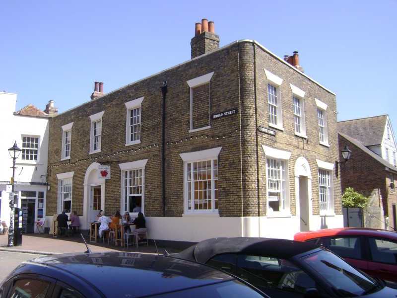
BROAD STREET
1.
1380 (South East Side)
No 2
TR 3571 SW 2/106
II GV
2.
Formerly Crown Public House.
Early C19. 2 storeys and basement stock brick. Stone coping. Rainwater head.
3 sashes with glazing bits intact and 1 blank. Ground floor has 3 3-light sashes
and a round-headed doorcase. The side elevation has 3 sashes.
No 2 and Nos 6 to 10 (even) form a group
Listing NGR: TR3541271062
External links are from the relevant listing authority and, where applicable, Wikidata. Wikidata IDs may be related buildings as well as this specific building. If you want to add or update a link, you will need to do so by editing the Wikidata entry.


Other nearby listed buildings
