Approximate Location Map
Large Map »
Latitude: 51.7351 / 51°44'6"N
Longitude: -2.2763 / 2°16'34"W
OS Eastings: 381015
OS Northings: 204082
OS Grid: SO810040
Mapcode National: GBR 0LC.1BV
Mapcode Global: VH94X.HNG6
Plus Code: 9C3VPPPF+3F
Entry Name: Horrell Monument in the Churchyard Approx 5M South of S Chapel to Church of St George
Listing Date: 24 February 1987
Grade: II
Source: Historic England
Source ID: 1090721
English Heritage Legacy ID: 131904
ID on this website: 101090721
Location: St George's Church, King's Stanley, Stroud, Gloucestershire, GL10
County: Gloucestershire
District: Stroud
Civil Parish: King's Stanley
Built-Up Area: Stroud
Traditional County: Gloucestershire
Lieutenancy Area (Ceremonial County): Gloucestershire
Church of England Parish: Kings Stanley
Church of England Diocese: Gloucester
Tagged with: Monument
SO 8104 KING'S STANLEY ST. GEORGE'S AVENUE
(north end)
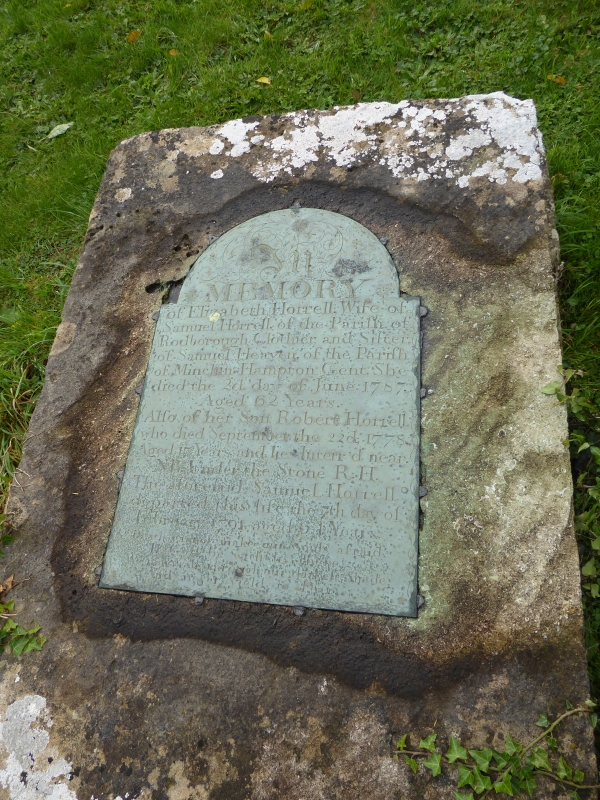
10/30 Horrell monument in the churchyard
approximately 5m south of south
chapel to Church of St. George
GV II
Slab memorial on stepped base with inscription plate. Dated 1787.
Plate engraved by Cook of Minchinhampton. Limestone with brass
plate. Monolithic slab with round-topped plate inscribed to
Elizabeth Horrell, Wife of Samuel Horrell of the Parish of
Rodborough, Clothier, died 1787. A good example of this local
traditional type of monument.
Listing NGR: SO8101504082
External links are from the relevant listing authority and, where applicable, Wikidata. Wikidata IDs may be related buildings as well as this specific building. If you want to add or update a link, you will need to do so by editing the Wikidata entry.


Other nearby listed buildings
