Approximate Location Map
Large Map »
Latitude: 51.9135 / 51°54'48"N
Longitude: -2.0444 / 2°2'39"W
OS Eastings: 397039
OS Northings: 223881
OS Grid: SO970238
Mapcode National: GBR 2LZ.ZYM
Mapcode Global: VHB1Q.J51H
Plus Code: 9C3VWX74+96
Entry Name: The Bakery Stores
Listing Date: 4 July 1960
Grade: II
Source: Historic England
Source ID: 1091901
English Heritage Legacy ID: 134472
ID on this website: 101091901
Location: Prestbury, Cheltenham, Gloucestershire, GL52
County: Gloucestershire
District: Cheltenham
Civil Parish: Prestbury
Built-Up Area: Cheltenham
Traditional County: Gloucestershire
Lieutenancy Area (Ceremonial County): Gloucestershire
Church of England Parish: Prestbury St Mary
Church of England Diocese: Gloucester
Tagged with: Building Thatched cottage
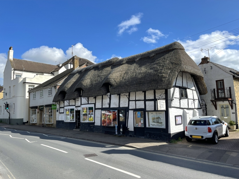
SO 9723 PRESTBURY HIGH STREET
(south side)
20/67 No 10 (The Bakery Stores)
4.7.60
GV II
House/shop at the end of a row. C17. Square-panelled timber
framing with rendered infill. Thatched roof. Rectangular plan to
main body with later extensions at rear. 1½ storeys. Four bays.
Three eyebrow dormers to first floor with early 2 and 3-light
casements with leaded panes. Three canted bays to ground floor.
Plate glass window far right. Blocked part-glazed door to left.
Two part-glazed C19 doorways.
Interior; part of cruck truss visible either side of fireplace at
point where roofline changes in height.
Listing NGR: SO9703923881
External links are from the relevant listing authority and, where applicable, Wikidata. Wikidata IDs may be related buildings as well as this specific building. If you want to add or update a link, you will need to do so by editing the Wikidata entry.


Other nearby listed buildings
