Approximate Location Map
Large Map »
Latitude: 51.23 / 51°13'47"N
Longitude: -1.0014 / 1°0'4"W
OS Eastings: 469822
OS Northings: 148341
OS Grid: SU698483
Mapcode National: GBR B6Z.ZK0
Mapcode Global: VHDXY.LBGX
Plus Code: 9C3W6XHX+XC
Entry Name: The Old Vicarage, Stable Block
Listing Date: 17 October 1984
Grade: II
Source: Historic England
Source ID: 1092755
English Heritage Legacy ID: 139172
ID on this website: 101092755
Location: Upton Grey, Basingstoke and Deane, Hampshire, RG25
County: Hampshire
District: Basingstoke and Deane
Civil Parish: Upton Grey
Built-Up Area: Upton Grey
Traditional County: Hampshire
Lieutenancy Area (Ceremonial County): Hampshire
Church of England Parish: Upton Grey St Mary
Church of England Diocese: Winchester
Tagged with: Building
SU 6948 UPTON GREY CHURCH STREET
23/5
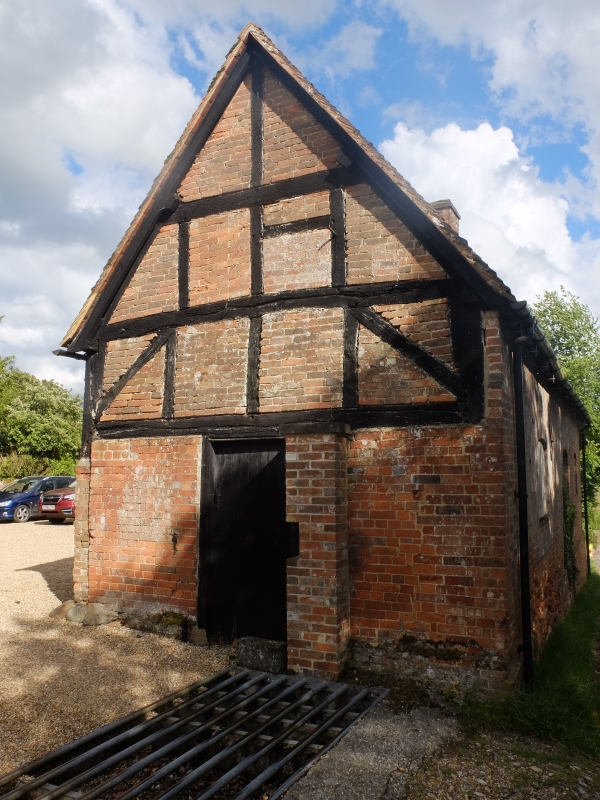
The Old Vicarage,
Stable Block
II
Adjoining the roadway east of the house, the building is mainly late C18, with old tile roof, red brick walling in Flemish Garden Wall bond, cambered openings (2 filled) and plinth. The west gable has an exposed C17 timber-frame in its upper part, the east gable has Victorian details, including a decorative bargeboard. Included for group value.
External links are from the relevant listing authority and, where applicable, Wikidata. Wikidata IDs may be related buildings as well as this specific building. If you want to add or update a link, you will need to do so by editing the Wikidata entry.


Other nearby listed buildings
