Approximate Location Map
Large Map »
Latitude: 51.3868 / 51°23'12"N
Longitude: 1.3823 / 1°22'56"E
OS Eastings: 635430
OS Northings: 170738
OS Grid: TR354707
Mapcode National: GBR WZS.VPW
Mapcode Global: VHLG6.XD4Q
Plus Code: 9F3399PJ+PW
Entry Name: 51, Hawley Square
Listing Date: 10 April 1951
Grade: II
Source: Historic England
Source ID: 1094631
English Heritage Legacy ID: 356572
ID on this website: 101094631
Location: Margate, Thanet, Kent, CT9
County: Kent
District: Thanet
Electoral Ward/Division: Margate Central
Parish: Non Civil Parish
Built-Up Area: Margate
Traditional County: Kent
Lieutenancy Area (Ceremonial County): Kent
Tagged with: Building
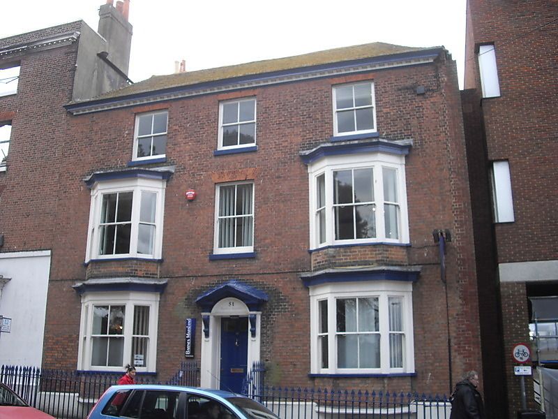
HAWLEY SQUARE
1.
1380
(West Side)
No 51
TR 3570 NW 1/51 10.4.51.
II GV
2.
Late C18. 3 storeys and basement with area red brick. Hipped tiled roof.
Modillion eaves cornice without a parapet. 3 windows. 2 bay windows on the
ground and first floors. Doorcase with pilasters, open pediment, and 6 panel
moulded door, the top two panels cut away and glazed.
Nos 39 to 51 (consec) form a group
Listing NGR: TR3543070738
External links are from the relevant listing authority and, where applicable, Wikidata. Wikidata IDs may be related buildings as well as this specific building. If you want to add or update a link, you will need to do so by editing the Wikidata entry.


Other nearby listed buildings
