Approximate Location Map
Large Map »
Latitude: 51.3898 / 51°23'23"N
Longitude: 1.3836 / 1°23'0"E
OS Eastings: 635501
OS Northings: 171077
OS Grid: TR355710
Mapcode National: GBR WZS.W1G
Mapcode Global: VHLG6.XBSD
Plus Code: 9F3399QM+WC
Entry Name: 33, King Street
Listing Date: 15 December 1970
Grade: II
Source: Historic England
Source ID: 1094645
English Heritage Legacy ID: 356599
ID on this website: 101094645
Location: Margate, Thanet, Kent, CT9
County: Kent
District: Thanet
Electoral Ward/Division: Margate Central
Parish: Non Civil Parish
Built-Up Area: Margate
Traditional County: Kent
Lieutenancy Area (Ceremonial County): Kent
Tagged with: Building
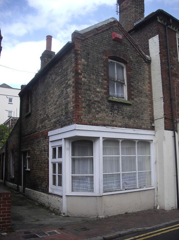
KING STREET
1.
1380
(North Side)
No 11
TR 3571 SW 2/214
TR 3571 SE 3/214 15.12.70.
II GV
2.
Listed for group value. Mid C19. 2 storeys stock brick with red brick
dressings. Gable front. Ground floor shopfront on corner.
Nos 15 to 35 (odd) and No 91 Trinity Square form a group
Listing NGR: TR3550171076
External links are from the relevant listing authority and, where applicable, Wikidata. Wikidata IDs may be related buildings as well as this specific building. If you want to add or update a link, you will need to do so by editing the Wikidata entry.


Other nearby listed buildings
