Approximate Location Map
Large Map »
Latitude: 51.3889 / 51°23'19"N
Longitude: 1.3858 / 1°23'9"E
OS Eastings: 635664
OS Northings: 170978
OS Grid: TR356709
Mapcode National: GBR WZS.WQF
Mapcode Global: VHLG6.ZC04
Plus Code: 9F3399QP+H8
Entry Name: 93, 95 and 95A, King Street
Listing Date: 22 February 1973
Grade: II
Source: Historic England
Source ID: 1094646
English Heritage Legacy ID: 356602
ID on this website: 101094646
Location: Margate, Thanet, Kent, CT9
County: Kent
District: Thanet
Electoral Ward/Division: Margate Central
Parish: Non Civil Parish
Built-Up Area: Margate
Traditional County: Kent
Lieutenancy Area (Ceremonial County): Kent
Tagged with: Building
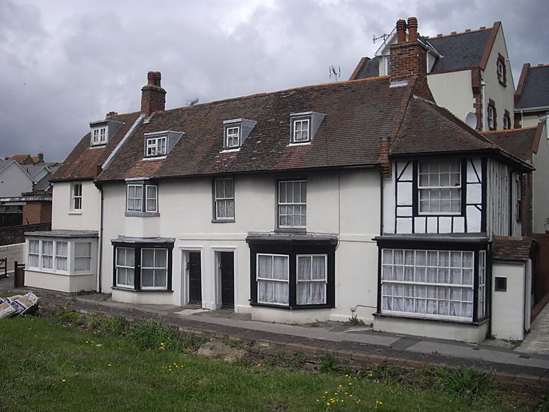
KING STREET
1.
1380
(North Side)
No 93
Nos 95 and 95A
TR 3570 NE 6/216
II
2.
C18. 2 storeys stuccoed. Old tiled roof with 3 dormers. 4 sashes with most
glazing bars intact, one of which is a 3-light canted bay. Stringcourse.
Ground floor has been spoiled by the addition of 3 bays. Simple doorcases in
moulded wooden architraves. No 95A has a weatherhood.
Listing NGR: TR3566470978
External links are from the relevant listing authority and, where applicable, Wikidata. Wikidata IDs may be related buildings as well as this specific building. If you want to add or update a link, you will need to do so by editing the Wikidata entry.


Other nearby listed buildings
