Approximate Location Map
Large Map »
Latitude: 51.3894 / 51°23'21"N
Longitude: 1.3816 / 1°22'53"E
OS Eastings: 635367
OS Northings: 171025
OS Grid: TR353710
Mapcode National: GBR WZS.VGH
Mapcode Global: VHLG6.WBRQ
Plus Code: 9F3399QJ+QJ
Entry Name: 2, Market Place
Listing Date: 22 February 1973
Grade: II
Source: Historic England
Source ID: 1094652
English Heritage Legacy ID: 356619
ID on this website: 101094652
Location: Margate, Thanet, Kent, CT9
County: Kent
District: Thanet
Electoral Ward/Division: Margate Central
Parish: Non Civil Parish
Built-Up Area: Margate
Traditional County: Kent
Lieutenancy Area (Ceremonial County): Kent
Tagged with: Building
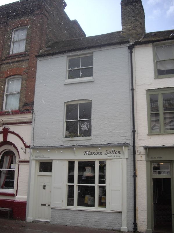
MARKET PLACE
1.
1380
(West Side)
No 2
TR 3571 SW 2/241
II GV
2.
Early C19. 3 storeys stock brick. Tiled roof. 1 sash with verticals only.
C19 shopfront. Included for group value.
Nos 2 to 5A (consec) form a group
Listing NGR: TR3536771025
External links are from the relevant listing authority and, where applicable, Wikidata. Wikidata IDs may be related buildings as well as this specific building. If you want to add or update a link, you will need to do so by editing the Wikidata entry.


Other nearby listed buildings
