Approximate Location Map
Large Map »
Latitude: 51.3892 / 51°23'21"N
Longitude: 1.3814 / 1°22'52"E
OS Eastings: 635351
OS Northings: 170996
OS Grid: TR353709
Mapcode National: GBR WZS.VF9
Mapcode Global: VHLG6.WBMX
Plus Code: 9F3399QJ+MG
Entry Name: 2, Market Street
Listing Date: 22 February 1973
Grade: II
Source: Historic England
Source ID: 1094658
English Heritage Legacy ID: 356632
ID on this website: 101094658
Location: Margate, Thanet, Kent, CT9
County: Kent
District: Thanet
Electoral Ward/Division: Margate Central
Parish: Non Civil Parish
Built-Up Area: Margate
Traditional County: Kent
Lieutenancy Area (Ceremonial County): Kent
Tagged with: Building
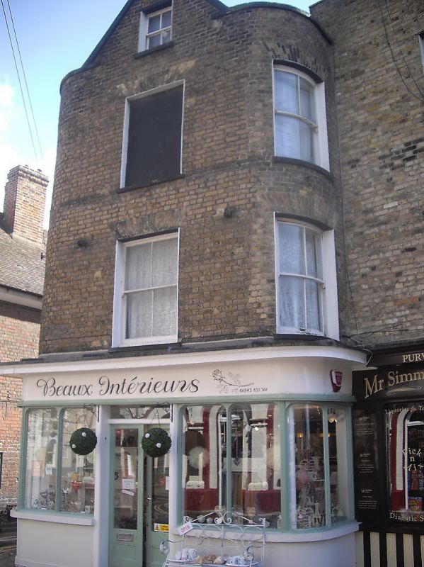
MARKET STREET
1.
1380
(South Side)
No 2
TR 3570 NW 1/252
TR 3571 SW 2/252
II GV
2.
Early C19. 3 storeys stock brick. 1 sash with verticals only on front
elevation and 1 corner sash. 3 on the side elevation. Simple round-headed
doorcase with 6 fielded panelled door on side elevation, C19 shopfront on
front elevation.
Nos 1 to 3 (consec) form a group.
Listing NGR: TR3535170996
External links are from the relevant listing authority and, where applicable, Wikidata. Wikidata IDs may be related buildings as well as this specific building. If you want to add or update a link, you will need to do so by editing the Wikidata entry.


Other nearby listed buildings
