Approximate Location Map
Large Map »
Latitude: 51.3854 / 51°23'7"N
Longitude: 1.3842 / 1°23'3"E
OS Eastings: 635569
OS Northings: 170585
OS Grid: TR355705
Mapcode National: GBR WZZ.2SL
Mapcode Global: VHLG6.YF4T
Plus Code: 9F3399PM+5M
Entry Name: 18, St John's Road
Listing Date: 22 February 1973
Grade: II
Source: Historic England
Source ID: 1094676
English Heritage Legacy ID: 356669
ID on this website: 101094676
Location: Margate, Thanet, Kent, CT9
County: Kent
District: Thanet
Electoral Ward/Division: Margate Central
Parish: Non Civil Parish
Built-Up Area: Margate
Traditional County: Kent
Lieutenancy Area (Ceremonial County): Kent
Tagged with: Building
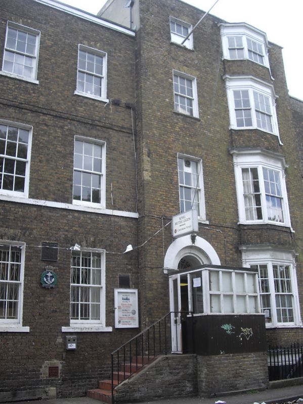
ST JOHN'S ROAD
1.
1380
(South West Side)
No 18
TR 3570 NE 6/59
II GV
2.
A large early C19 brown brick house. 3 to 4 storeys and basement. Stone
coping. 3 sashes and 1 3-light canted bay through all storeys. Good central
round headed doorcase with decorated keystone, fluted Ionic half columns,
semi-circular fanlight and six panel moulded door.
Nos 18 and 18A form a group
Listing NGR: TR3556970585
External links are from the relevant listing authority and, where applicable, Wikidata. Wikidata IDs may be related buildings as well as this specific building. If you want to add or update a link, you will need to do so by editing the Wikidata entry.


Other nearby listed buildings
