Approximate Location Map
Large Map »
Latitude: 51.3865 / 51°23'11"N
Longitude: 1.3876 / 1°23'15"E
OS Eastings: 635798
OS Northings: 170722
OS Grid: TR357707
Mapcode National: GBR WZZ.3LQ
Mapcode Global: VHMCP.0DFY
Plus Code: 9F3399PQ+J2
Entry Name: Addington House
Listing Date: 22 February 1973
Grade: II
Source: Historic England
Source ID: 1095051
English Heritage Legacy ID: 356716
ID on this website: 101095051
Location: Margate, Thanet, Kent, CT9
County: Kent
District: Thanet
Electoral Ward/Division: Cliftonville West
Parish: Non Civil Parish
Built-Up Area: Margate
Traditional County: Kent
Lieutenancy Area (Ceremonial County): Kent
Tagged with: House
TR 3570 NE
6/340
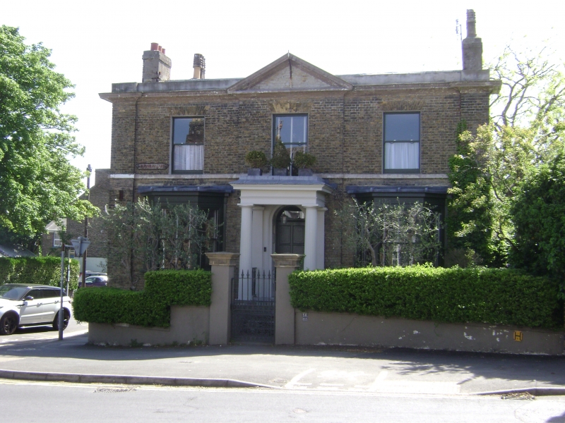
VICTORIA ROAD (South East Side)
No 58 (Addington House)
(Formerly listed as No 58 (Welton House))
II
Mid C19. Two storeys and basement brown brick. Stone parapet with dropped moulded eaves cornice. Central pediment. Three sashes without glazing bars. Ground floor has two three-light canted bays. Central porch with two Greek Doric columns and Doric pilasters.
Listing NGR: TR3579870722
External links are from the relevant listing authority and, where applicable, Wikidata. Wikidata IDs may be related buildings as well as this specific building. If you want to add or update a link, you will need to do so by editing the Wikidata entry.


Other nearby listed buildings
