Approximate Location Map
Large Map »
Latitude: 51.0501 / 51°3'0"N
Longitude: -1.3226 / 1°19'21"W
OS Eastings: 447580
OS Northings: 128075
OS Grid: SU475280
Mapcode National: GBR 867.2FP
Mapcode Global: FRA 863B.Y91
Plus Code: 9C3W3M2G+2X
Entry Name: White Horse Public House
Listing Date: 14 January 1974
Last Amended: 11 March 1975
Grade: II
Source: Historic England
Source ID: 1095307
English Heritage Legacy ID: 144888
Also known as: White Horse, Winchester
White Horse
ID on this website: 101095307
Location: St Cross, Winchester, Hampshire, SO23
County: Hampshire
District: Winchester
Electoral Ward/Division: St Michael
Parish: Non Civil Parish
Built-Up Area: Winchester
Traditional County: Hampshire
Lieutenancy Area (Ceremonial County): Hampshire
Church of England Parish: Winchester St Cross Hospital with St Faith
Church of England Diocese: Winchester
Tagged with: Pub
ST CROSS ROAD
1.
1833 (East Side)
No 55
(White Hart
Public House)
SU 42 NE 12/347
II GV
2.
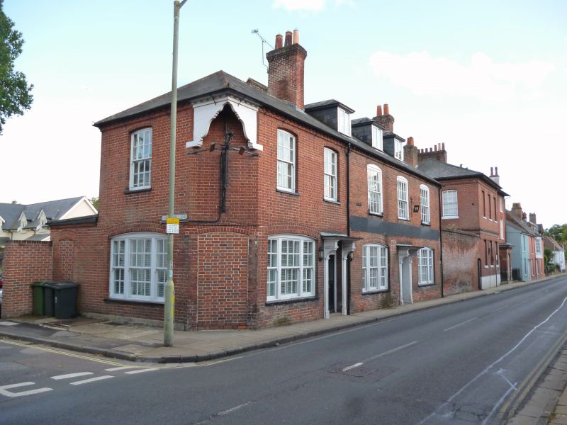
Late C18/Early C19. Red brick. Two storeys and attic. Two windows on ground
floor, tripartite sashes, the plain sashes above, all in elliptical heads with
flush frames and glazing bars. Central door with modern surround and bracketted
hood. Slate roof with three flat topped dormers. C19 two window extension in
kind to left.
Nos 53 to 63 (odd) form a group.
No 55 (White Hart Public House) shall be amended to read No 55 (White Horse
Public House).
------------------------------------
ST CROSS ROAD
1.
1833
(East Side)
No 55
(White Hart
Public House)
SU 42 NE 12/347
II GV
2.
Late C18/Early C19. Red brick. Two storeys and attic. Two windows on
ground floor, tripartite sashes, the plain sashes above, all in elliptical
heads with flush frames and glazing bars. Central door with modern surround
and bracketted hood. Slate roof with three flat topped dormers. C19
two window extension in kind to left.
Nos 53 to 63 (odd) form a group.
Listing NGR: SU4758028072
External links are from the relevant listing authority and, where applicable, Wikidata. Wikidata IDs may be related buildings as well as this specific building. If you want to add or update a link, you will need to do so by editing the Wikidata entry.


Other nearby listed buildings
