Approximate Location Map
Large Map »
Latitude: 51.0639 / 51°3'50"N
Longitude: -1.3148 / 1°18'53"W
OS Eastings: 448109
OS Northings: 129622
OS Grid: SU481296
Mapcode National: GBR 861.BD7
Mapcode Global: FRA 8649.ML5
Plus Code: 9C3W3M7P+H3
Entry Name: Garden Wall of the Royal Hotel
Listing Date: 14 January 1974
Grade: II
Source: Historic England
Source ID: 1095352
English Heritage Legacy ID: 144799
ID on this website: 101095352
Location: Winchester, Hampshire, SO23
County: Hampshire
District: Winchester
Electoral Ward/Division: St Michael
Parish: Non Civil Parish
Built-Up Area: Winchester
Traditional County: Hampshire
Lieutenancy Area (Ceremonial County): Hampshire
Church of England Parish: Winchester Holy Trinity
Church of England Diocese: Winchester
Tagged with: Wall
ST PETER STREET
1
1833
(East Side)
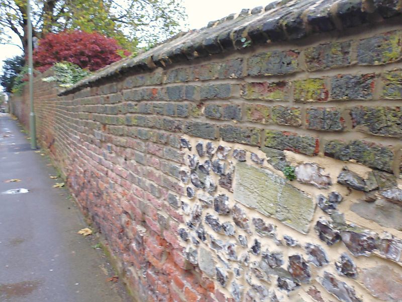
Garden Wall of
The Royal Hotel
SU 4829 NW 3/225A
II GV
2.
C18. Red brick. Partly older stone and flint.
The Royal Hotel and garden wall, and Nos 2 to 9 (consec), 22 and 23
form a group.
Listing NGR: SU4813629614
External links are from the relevant listing authority and, where applicable, Wikidata. Wikidata IDs may be related buildings as well as this specific building. If you want to add or update a link, you will need to do so by editing the Wikidata entry.


Other nearby listed buildings
