Approximate Location Map
Large Map »
Latitude: 51.058 / 51°3'28"N
Longitude: -1.3111 / 1°18'40"W
OS Eastings: 448373
OS Northings: 128966
OS Grid: SU483289
Mapcode National: GBR 861.R9Y
Mapcode Global: FRA 864B.30W
Plus Code: 9C3W3M5Q+6G
Entry Name: Boundary Wall on College Street and College Walk St Mary's College
Listing Date: 14 January 1974
Grade: II
Source: Historic England
Source ID: 1095494
English Heritage Legacy ID: 144554
ID on this website: 101095494
Location: Wharf Hill, Winchester, Hampshire, SO23
County: Hampshire
District: Winchester
Electoral Ward/Division: St Michael
Parish: Non Civil Parish
Built-Up Area: Winchester
Traditional County: Hampshire
Lieutenancy Area (Ceremonial County): Hampshire
Tagged with: Wall
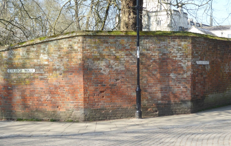
1.
1833 COLLEGE STREET
(South Side)
St Mary's College.
Boundary Wall on College
Street and
College Walk
SU 4828 NW 8/336
II GV
2.
Early C19. Red brick.
All the listed buildings in College Street form a group.
Listing NGR: SU4826829006
External links are from the relevant listing authority and, where applicable, Wikidata. Wikidata IDs may be related buildings as well as this specific building. If you want to add or update a link, you will need to do so by editing the Wikidata entry.


Other nearby listed buildings
