Approximate Location Map
Large Map »
Latitude: 52.1759 / 52°10'33"N
Longitude: -2.1956 / 2°11'44"W
OS Eastings: 386718
OS Northings: 253090
OS Grid: SO867530
Mapcode National: GBR 1GC.HQW
Mapcode Global: VH92T.WKMT
Plus Code: 9C4V5RG3+9P
Entry Name: Barn About 50 Metres South-East of Middle Battenhall Farmhouse
Listing Date: 26 November 1986
Grade: II
Source: Historic England
Source ID: 1095983
English Heritage Legacy ID: 147294
ID on this website: 101095983
Location: Red Hill, Worcester, Worcestershire, WR7
County: Worcestershire
District: Worcester
Civil Parish: St. Peter the Great County
Traditional County: Worcestershire
Lieutenancy Area (Ceremonial County): Worcestershire
Church of England Parish: Worcester, St Martin with St Peter and Whittington
Church of England Diocese: Worcester
Tagged with: Barn
ST PETER THE GREAT COUNTY CP -
SO 85 SE
4/602 Barn about 50 metres south-
east of Middle Battenhall
Farmhouse
GV II
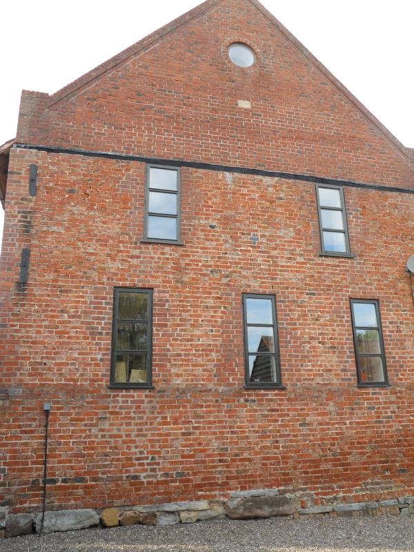
Barn. C17 with mid-C18 and late C19 additions and alterations. Timber-frame on
stone plinth, partial brick infill, part weatherboarded; brick extension, tile
roof. Nine bays aligned east/west, the seven bays to the west C17 timber-frame
with central threshing floor; additional two bays in C18 brick to east, with
western of two bays having a threshing floor; the east gable has a brick coped
verge and owl hole dressed in stone. Framing: three square panels high with a
little woven infill remaining; all roof trusses have two queen struts to collar
and trenched purlins.
Listing NGR: SO8619552482
External links are from the relevant listing authority and, where applicable, Wikidata. Wikidata IDs may be related buildings as well as this specific building. If you want to add or update a link, you will need to do so by editing the Wikidata entry.


Other nearby listed buildings
