Approximate Location Map
Large Map »
Latitude: 51.2826 / 51°16'57"N
Longitude: 1.0703 / 1°4'13"E
OS Eastings: 614212
OS Northings: 158195
OS Grid: TR142581
Mapcode National: GBR TY2.FFY
Mapcode Global: VHLGM.H1P2
Plus Code: 9F3373MC+24
Entry Name: 17, New Street
Listing Date: 7 September 1973
Grade: II
Source: Historic England
Source ID: 1096941
English Heritage Legacy ID: 439800
ID on this website: 101096941
Location: St Dunstan's, Canterbury, Kent, CT2
County: Kent
District: Canterbury
Electoral Ward/Division: Westgate
Parish: Non Civil Parish
Built-Up Area: Canterbury
Traditional County: Kent
Lieutenancy Area (Ceremonial County): Kent
Tagged with: Building
1.
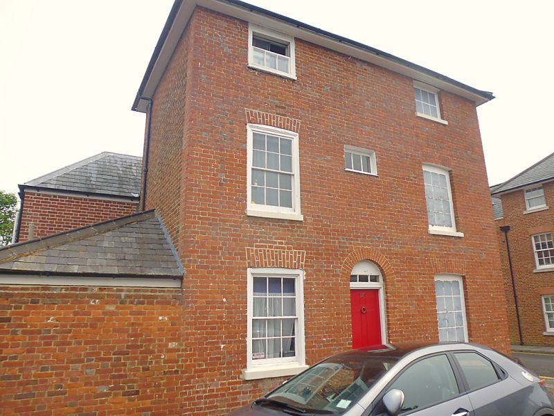
944 NEW STREET
(North East Side)
No 17
TR 1458 SW 1/578
II GV
2.
This is the end building of a terrace in Cross Street. 3 storeys and basement
red brick. Hipped tiled roof. 1 sash, 1 blank. Cambered arches. Simple round-headed
doorcase with 6 panelled door.
Forms a group with Nos 11 to 30 (consec) Cross Street.
Listing NGR: TR1421258195
External links are from the relevant listing authority and, where applicable, Wikidata. Wikidata IDs may be related buildings as well as this specific building. If you want to add or update a link, you will need to do so by editing the Wikidata entry.


Other nearby listed buildings
