Approximate Location Map
Large Map »
Latitude: 52.3348 / 52°20'5"N
Longitude: -2.0611 / 2°3'39"W
OS Eastings: 395933
OS Northings: 270750
OS Grid: SO959707
Mapcode National: GBR 2FY.MQ0
Mapcode Global: VH9ZL.7K7Z
Plus Code: 9C4V8WMQ+WH
Entry Name: 49, High Street
Listing Date: 1 November 1972
Grade: II
Source: Historic England
Source ID: 1099549
English Heritage Legacy ID: 155698
ID on this website: 101099549
Location: Bromsgrove, Worcestershire, B61
County: Worcestershire
District: Bromsgrove
Electoral Ward/Division: Sanders Park
Parish: Non Civil Parish
Built-Up Area: Bromsgrove
Traditional County: Worcestershire
Lieutenancy Area (Ceremonial County): Worcestershire
Church of England Parish: Bromsgrove
Church of England Diocese: Worcester
Tagged with: Building
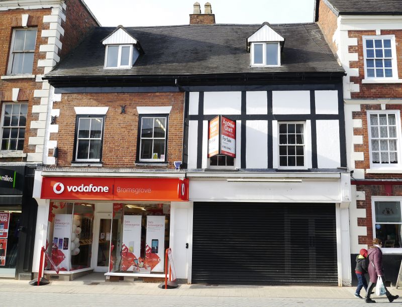
HIGH STREET
1.
909
(North West Side)
No 49
SO 9570 NE 2/112
II
2.
Late C17/early C18 much altered. Stucco. Two storeys and attic. One window,
bay of sashes with carved angles and cornice. Modern shop. Slate roof.
Dormer. Moulded stone eaves. Quoins.
Listing NGR: SO9593370750
External links are from the relevant listing authority and, where applicable, Wikidata. Wikidata IDs may be related buildings as well as this specific building. If you want to add or update a link, you will need to do so by editing the Wikidata entry.


Other nearby listed buildings
