Approximate Location Map
Large Map »
Latitude: 51.752 / 51°45'7"N
Longitude: -0.34 / 0°20'23"W
OS Eastings: 514687
OS Northings: 207224
OS Grid: TL146072
Mapcode National: GBR H89.4VZ
Mapcode Global: VHGPQ.2748
Plus Code: 9C3XQM26+Q2
Entry Name: Wellington Public House
Listing Date: 23 July 1971
Grade: II
Source: Historic England
Source ID: 1103112
English Heritage Legacy ID: 163368
Also known as: Wellington, St Albans
Wellington
ID on this website: 101103112
Location: St Albans, St. Albans, Hertfordshire, AL3
County: Hertfordshire
District: St. Albans
Electoral Ward/Division: St Peters
Parish: Non Civil Parish
Built-Up Area: St Albans
Traditional County: Hertfordshire
Lieutenancy Area (Ceremonial County): Hertfordshire
Church of England Parish: Abbey Parish of St Albans
Church of England Diocese: St.Albans
Tagged with: Pub
MARKET PLACE
1. (West Side)
1582
No 17
(Wellington Public House)
No 19
TL 1407 SE 9/331 25.7.71.
II GV
2.
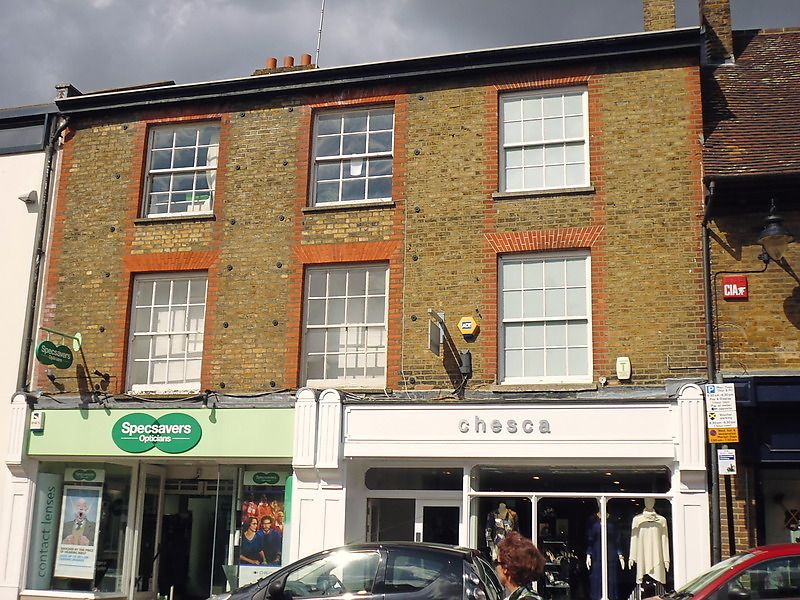
Early C19 3 storeys, grey brick with red dressings. Sash windows, 4
panes wide, 3 of them across whole front. Modern shop and bar fronts
but Wellington P H has attractive octagonal lantern suspended from
bracket. It is probably late C19. The 1st floor right hand window
is modern and of mullion and transom casement form. Plain eaves with
gutter. Flat pitched slate roof.
Nos 17 to 23 (odd) form a group.
Listing NGR: TL1468707224
External links are from the relevant listing authority and, where applicable, Wikidata. Wikidata IDs may be related buildings as well as this specific building. If you want to add or update a link, you will need to do so by editing the Wikidata entry.


Other nearby listed buildings
