Approximate Location Map
Large Map »
Latitude: 50.6833 / 50°41'0"N
Longitude: -3.4656 / 3°27'56"W
OS Eastings: 296556
OS Northings: 88101
OS Grid: SX965881
Mapcode National: GBR P2.JRLQ
Mapcode Global: FRA 37M8.HPR
Plus Code: 9C2RMGMM+8Q
Entry Name: 66 and 67, Fore Street
Listing Date: 18 June 1974
Grade: II
Source: Historic England
Source ID: 1103913
English Heritage Legacy ID: 89162
ID on this website: 101103913
Location: Topsham, Exeter, Devon, EX3
County: Devon
District: Exeter
Electoral Ward/Division: Topsham
Parish: Non Civil Parish
Built-Up Area: Topsham
Traditional County: Devon
Lieutenancy Area (Ceremonial County): Devon
Church of England Parish: Topsham St Margaret
Church of England Diocese: Exeter
Tagged with: Building
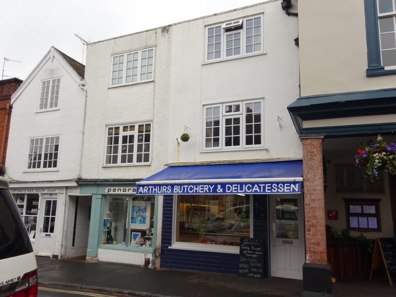
FORE STREET
1092
(West Side)
TOPSHAM
Nos 66 and 67
SX 9687 8/903
II GV
2.
Late C18 or Early C19 stucco front on an earlier building. Three storeys, one
window each, sashes. Modern shop fronts. Parapet, hipped roof behind.
All the listed buildings in Fore Street form a group.
Listing NGR: SX9655588099
External links are from the relevant listing authority and, where applicable, Wikidata. Wikidata IDs may be related buildings as well as this specific building. If you want to add or update a link, you will need to do so by editing the Wikidata entry.


Other nearby listed buildings
