Approximate Location Map
Large Map »
Latitude: 50.6833 / 50°40'59"N
Longitude: -3.4668 / 3°28'0"W
OS Eastings: 296468
OS Northings: 88093
OS Grid: SX964880
Mapcode National: GBR P2.JR7S
Mapcode Global: FRA 37M8.H6G
Plus Code: 9C2RMGMM+87
Entry Name: 14, Ferry Road
Listing Date: 18 June 1974
Grade: II
Source: Historic England
Source ID: 1103954
English Heritage Legacy ID: 89066
ID on this website: 101103954
Location: Topsham, Exeter, Devon, EX3
County: Devon
District: Exeter
Electoral Ward/Division: Topsham
Parish: Non Civil Parish
Built-Up Area: Topsham
Traditional County: Devon
Lieutenancy Area (Ceremonial County): Devon
Church of England Parish: Topsham St Margaret
Church of England Diocese: Exeter
Tagged with: Building
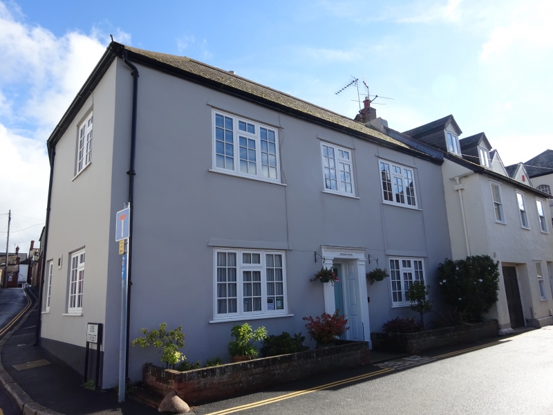
FERRY ROAD
1.
1092
(East Side)
TOPSHAM
No 14
SX 9687 8/813
II GV
Early Cl9. Red brick, but rebuilt and plastered. 2 storeys, 3 windows, modern
casements. Good simple doorcase. Slate roof. Included for group value.
Nos 8 to 10 (consec), Passage Inn Nos 13 to 15 (consec) the Nail House
and the Nail Cellars form a group.
Listing NGR: SX9646888093
External links are from the relevant listing authority and, where applicable, Wikidata. Wikidata IDs may be related buildings as well as this specific building. If you want to add or update a link, you will need to do so by editing the Wikidata entry.


Other nearby listed buildings
