Approximate Location Map
Large Map »
Latitude: 50.6845 / 50°41'4"N
Longitude: -3.4683 / 3°28'5"W
OS Eastings: 296368
OS Northings: 88231
OS Grid: SX963882
Mapcode National: GBR P2.JJW1
Mapcode Global: FRA 37M8.GM2
Plus Code: 9C2RMGMJ+QM
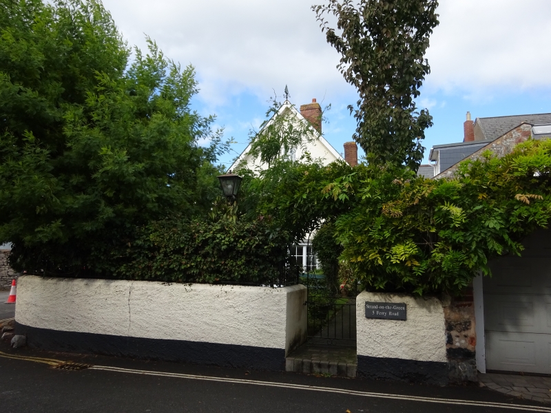
Entry Name: 4 and 5, Ferry Road
Listing Date: 18 June 1974
Grade: II
Source: Historic England
Source ID: 1103996
English Heritage Legacy ID: 89060
ID on this website: 101103996
Location: Topsham, Exeter, Devon, EX3
County: Devon
District: Exeter
Electoral Ward/Division: Topsham
Parish: Non Civil Parish
Built-Up Area: Topsham
Traditional County: Devon
Lieutenancy Area (Ceremonial County): Devon
Church of England Parish: Topsham St Margaret
Church of England Diocese: Exeter
Tagged with: Building
FERRY ROAD
1.
1092
(East Side)
TOPSHAM
Nos 4 and 5
SX 9687 8/808
II
2.
C18, altered. Roughcast. Two storeys with a three storey gable. Five windows
to pair on first floor, sashes with glazing bars, one blocked. Three similar below, one blank, casement in gable. Two panelled doors. Slate roof with red brick stack.
Listing NGR: SX9636888230
External links are from the relevant listing authority and, where applicable, Wikidata. Wikidata IDs may be related buildings as well as this specific building. If you want to add or update a link, you will need to do so by editing the Wikidata entry.


Other nearby listed buildings
