Approximate Location Map
Large Map »
Latitude: 50.9054 / 50°54'19"N
Longitude: -3.4273 / 3°25'38"W
OS Eastings: 299735
OS Northings: 112737
OS Grid: SS997127
Mapcode National: GBR LL.R9JW
Mapcode Global: FRA 36QQ.0L9
Plus Code: 9C2RWH4F+43
Entry Name: Crownhills Bridge
Listing Date: 11 June 1986
Grade: II
Source: Historic England
Source ID: 1105883
English Heritage Legacy ID: 95340
ID on this website: 101105883
Location: Halberton, Mid Devon, EX16
County: Devon
District: Mid Devon
Civil Parish: Halberton
Built-Up Area: Halberton
Traditional County: Devon
Lieutenancy Area (Ceremonial County): Devon
Church of England Parish: Halberton
Church of England Diocese: Exeter
Tagged with: Bridge
HALBERTON
SS 91 SE
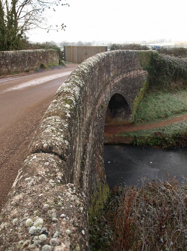
1/153 Crownhills Bridge
-
II
Bridge carrying minor road over Grand Western Canal; the canal was established under
on Act of 1796, and the Halberton section completed in 1814. All coursed
conglomerate. Single elliptical arch with string course; round-headed coping to
parapet. The roadway retains its kerb-blocks.
Listing NGR: SS9973512737
External links are from the relevant listing authority and, where applicable, Wikidata. Wikidata IDs may be related buildings as well as this specific building. If you want to add or update a link, you will need to do so by editing the Wikidata entry.


Other nearby listed buildings
