Approximate Location Map
Large Map »
Latitude: 51.5806 / 51°34'50"N
Longitude: 0.7073 / 0°42'26"E
OS Eastings: 587676
OS Northings: 190338
OS Grid: TQ876903
Mapcode National: GBR QNX.ZK6
Mapcode Global: VHKHF.6JSM
Plus Code: 9F32HPJ4+7W
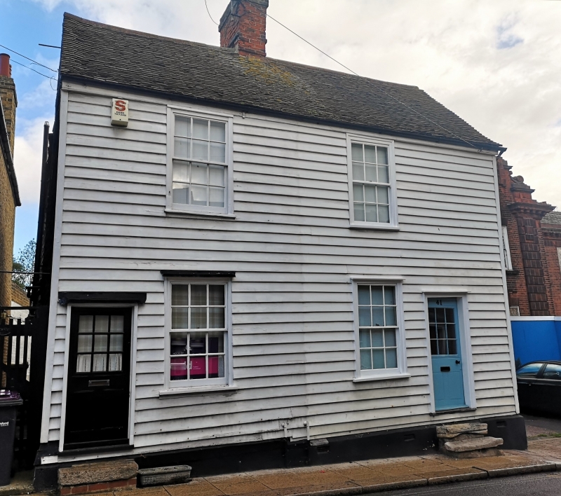
Entry Name: 39 and 41 South Street
Listing Date: 23 July 1973
Grade: II
Source: Historic England
Source ID: 1112561
English Heritage Legacy ID: 123242
ID on this website: 101112561
Location: Rochford, Essex, SS4
County: Essex
District: Rochford
Civil Parish: Rochford
Built-Up Area: Rochford
Traditional County: Essex
Lieutenancy Area (Ceremonial County): Essex
Church of England Parish: Rochford St Andrew
Church of England Diocese: Chelmsford
Tagged with: Building
TQ 8790 SE
16/252
ROCHFORD
SOUTH STREET (east side)
Nos. 39 and 41
23.7.73
GV
II
Pair of cottages. C18/C19. Timber framed and weatherboarded. Red plain tiled roof outshot at rear. Central red brick chimney stack. Two storeys. Two window range of small paned vertically sliding sashes; moulded surrounds. Step approach. To right and left half glazed doors, simple surrounds.
Listing NGR: TQ8767690338
External links are from the relevant listing authority and, where applicable, Wikidata. Wikidata IDs may be related buildings as well as this specific building. If you want to add or update a link, you will need to do so by editing the Wikidata entry.


Other nearby listed buildings
