Approximate Location Map
Large Map »
Latitude: 52.0615 / 52°3'41"N
Longitude: -0.5528 / 0°33'10"W
OS Eastings: 499310
OS Northings: 241330
OS Grid: SP993413
Mapcode National: GBR F1H.R1X
Mapcode Global: VHFQL.CGL1
Plus Code: 9C4X3C6W+HV
Entry Name: Moat Farmhouse
Listing Date: 22 October 1952
Grade: II*
Source: Historic England
Source ID: 1114050
English Heritage Legacy ID: 38359
ID on this website: 101114050
Location: Marston Moretaine, Central Bedfordshire, MK43
County: Central Bedfordshire
Civil Parish: Marston Moretaine
Built-Up Area: Marston Moretaine
Traditional County: Bedfordshire
Lieutenancy Area (Ceremonial County): Bedfordshire
Church of England Parish: Marston Morteyne
Church of England Diocese: St.Albans
Tagged with: Farmhouse
MARSTON MORETAINE WOBURN ROAD
SP 94 SE
SP 9841
3/62 Moat Farmhouse
22.10.52
- II*
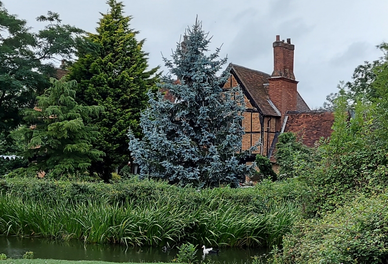
House, sited within a rectangular moat. Early C15, extended early C16, altered
later C16, and restored 1880. Timber frame with red brick infill, much of the
studding and brickwork dating from the C19. Clay tile roofs. Consisted
originally of open hall of cruck construction with cross-passage to E end.
Cross-wings added early C16 to both ends, that to SW being the 'solar' end.
Hall ceiled over late C16. 2 storeys throughout. Front elevation: cross-wings
are jettied at first floor level. Timber mullioned windows, 4 to ground floor,
5 to first floor, are all C19 and C20. Central block has C19 doorways to both
ends, RH one in position of original cross-passage. LH doorway sheltered by
C19 gabled timber and brick porch. LH gable has substantial external chimney
stack to outer wall, of dressed clunch and surmounted by rebuilt red brick
diagonal shafts. Central block has ridge stack, inserted late C16 but rebuilt
C19 RH cross-wing has C19 chimney stack with diagonal shafts. Rear elevation:
cross-wings project further than to front. Visible at LH end of hall is
blocked pointed arched doorway. Interior: variety of moulded timbers dating
from C15 and C16 centuries, including 3 reset doorheads with blind cusped
tracery. Carved stone fireplaes to SW cross-wing probably date from C19
restoration.
N.W. Alcock and P.J. Woodward, "Cruck-Frame Buildings in Bedfordshire", Beds
Archaeological Journal, vol II, 1976, pp 51-58 and 60.
Listing NGR: SP9931041330
External links are from the relevant listing authority and, where applicable, Wikidata. Wikidata IDs may be related buildings as well as this specific building. If you want to add or update a link, you will need to do so by editing the Wikidata entry.


Other nearby listed buildings
