Approximate Location Map
Large Map »
Latitude: 51.281 / 51°16'51"N
Longitude: 1.0764 / 1°4'35"E
OS Eastings: 614643
OS Northings: 158039
OS Grid: TR146580
Mapcode National: GBR TY2.NYV
Mapcode Global: VHLGM.L2X9
Plus Code: 9F3373JG+CH
Entry Name: 37, St Peter's Street
Listing Date: 3 May 1967
Grade: II
Source: Historic England
Source ID: 1116661
English Heritage Legacy ID: 442967
ID on this website: 101116661
Location: Canterbury, Kent, CT1
County: Kent
District: Canterbury
Electoral Ward/Division: Westgate
Parish: Non Civil Parish
Built-Up Area: Canterbury
Traditional County: Kent
Lieutenancy Area (Ceremonial County): Kent
Tagged with: Building
1.
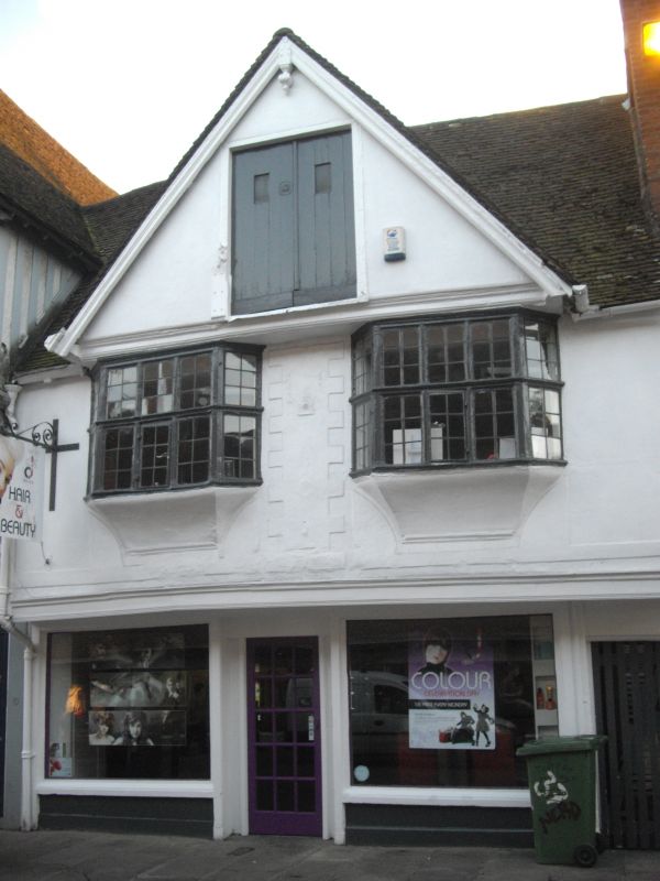
944 ST PETER'S STREET
(South West Side)
No 37
TR 1458 SE 2/76 3.5.67.
II GV
2.
A C16 timber-framed house restored. 2 storeys plastered with central gable.
Renovated tiled roof. Gable has trap door. 1st floor has 2 restored bay
windows. Later shop front.
NOs 34 to 39 (consec) form a group.
Listing NGR: TR1464358039
External links are from the relevant listing authority and, where applicable, Wikidata. Wikidata IDs may be related buildings as well as this specific building. If you want to add or update a link, you will need to do so by editing the Wikidata entry.


Other nearby listed buildings
