Approximate Location Map
Large Map »
Latitude: 51.1498 / 51°8'59"N
Longitude: 0.6875 / 0°41'15"E
OS Eastings: 588061
OS Northings: 142386
OS Grid: TQ880423
Mapcode National: GBR QV4.SRM
Mapcode Global: VHJN2.VCTD
Plus Code: 9F324MXQ+W2
Entry Name: Gillets House
Listing Date: 14 February 1967
Last Amended: 10 October 1980
Grade: II
Source: Historic England
Source ID: 1119635
English Heritage Legacy ID: 181261
ID on this website: 101119635
Location: Smarden, Ashford, Kent, TN27
County: Kent
District: Ashford
Civil Parish: Smarden
Built-Up Area: Smarden
Traditional County: Kent
Lieutenancy Area (Ceremonial County): Kent
Tagged with: House
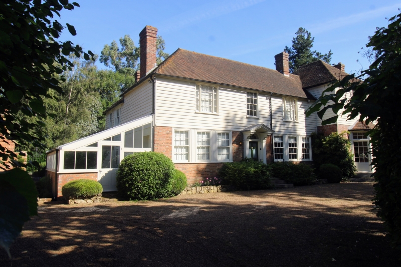
1.
5272 SMARDEN THE STREET
(north side)
Gillets House
(formerly listed as
Gillets under
High Street)
TQ 8842 29/5 14.2.67.
II GV
2.
Sir Charles Igglesden, in his "Saunters through Kent with a pen and pencil",
says that this house was built by Thomas Hinds in 1818. Two storeys. Ground
glazing bars intact. Ground floor portion built out of the west end. C19 addition
of one window bay at the east end.
Listing NGR: TQ8805742384
External links are from the relevant listing authority and, where applicable, Wikidata. Wikidata IDs may be related buildings as well as this specific building. If you want to add or update a link, you will need to do so by editing the Wikidata entry.


Other nearby listed buildings
